|
I finished up a few areas north of Unicoi State Park, near Helen. I should have it up and ready for folks to take a look in another week or two. I did drive a section of Tray Mountain Road that appears to be rarely traveled. It was not particularly difficult, just exceptionally rocky and slow-going and definitely not for the low(er) clearance AWD rigs unless you are exceedingly patient and careful. The roads covered on this trip were: Tray Mountain Rd, Indian Grave Gap Road, Corbin Creek Road and Mill Creek Road.
-David Would you prefer a .kmz file or a .gpx file? Up to this point, I have used the KML/KMZ file formats almost exclusively. The Keyhole Markup Language format works well when viewing the roads and features in Google Earth or Google Maps. However, I know that many of you may find it handy to have a .gpx file available. Here's your chance...let me know what you need. Should I offer a gpx file along with my usual kml/kmz? Do you prefer to handle the .gpx file conversion yourself?
-David Yep, you have to follow along on the official site for this, otherwise you may miss all the good times had by Curt and Paul. They made it to Fairbanks, Alaska. Curt continued on north to the Dalton Highway, crossing the Arctic Circle, and riding on to Coldfoot. After Curt returned to Fairbanks, the 2011 ATL to the Arctic Team began the long ride south.
As of 7 hours ago, SPOT is showing them near Jasper National Park in Alberta, Canada. If all goes to plan, they should be heading to Seattle and then home. Keep an eye on them and send them your love...and Susan G. Komen your money! -David The riding team of Curt and Paul Coulombe are just south of Roosville, on the US-Canada border. Cheer them on at ATL to the Arctic.
You can follow their position, as reported by the trusty Spot, Here. -David Visit my friends at ATL to the Arctic tonight for the Twisted Taco Buckhead fundraiser night from 6 until close. The Raffle starts at 8pm and you could win an Airtran Airways ticket! The departure is almost upon us, so drop in and wish Curt and his father good luck on their ride North. http://www.atltothearctic.com/ Curt's prepped Triumph Tiger: 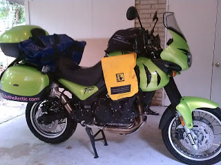 I have enjoyed the rooftop tent on my Montero for the last few years, but I finally decided it was not getting nearly enough use and it was time to pass it on to the next person. Brad drove down from Nashville in his very cool Quigley 4wd-converted Chevy van, having replaced the motor only one week earlier! We spent the morning modifying the mounts and preparing the van rack for the RTT. He left my driveway, heading West...then Canada, Alaska and the rest of the World! Safe travels, Brad and have a great time seeing the world over the next 5 years. 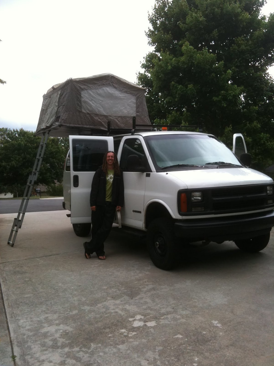 Family responsibilities and route planning for my good friends at ATLtotheArctic.com have kept me busy the last couple months. I'm eager to get back on the trails and resume my project, but there just never seems to be enough time in the day. In the meantime, check out my friends at ATLtotheArctic.com, share a kind word or donate what you can to Susan G Komen. Let me know if you donate and I will mail you a new GeorgiaOverland.com decal! -David 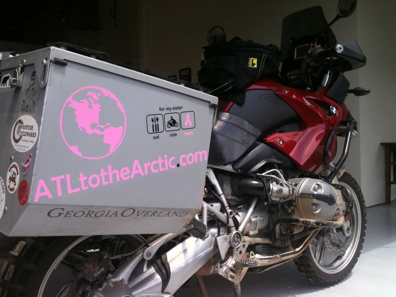 It's been more than a year since I posted my thoughts on this great app for the iPhone and I continue to use it for all my GeorgiaOverland.com trail capture. Numerous revisions, updates and improvements have brought us to v15.2 and it is now, for a limited time, ONLY $.99. Unbelievable. Buy this app today. You cannot beat this app and for only a buck you cannot beat the price, or the customer support. I have contacted them numerous times and they are always responsive. In fact, they have taken an interest in our humble little project here at GeorgiaOverland. Stay tuned for more details...
A few highlights included in the latest version:
-David A better title might be: How I managed to drive quite a few miles and still did not find the elusive route across the Chattahoochee National Forest between Highway 76 / Highway 2 and Highway 75 / Unicoi Turnpike...but that is just too long.
Keep in mind, this trip contains a number of paved miles that are not represented in the .kmz. Notations are made when pavement is reached, but the user should consult a good map to find the paved roads that connect the dirt and gravel sections. The first section of the Tallulah River Road to West Wildcat Creek Road route begins at the water crossing off Tallulah River Road, providing access to Charlies Creek Road. This section is approximately 8 miles of dirt and gravel road and includes a couple miles of dead end / return trip side road travel. Pavement is reached at Upper Hightower Creek Road. After traveling briefly on Upper Hightower Creek Road, a turn on to Barefoot Road yields a short section (< 1 mile) of dirt road and ends at the intersection of Barefoot Road and Hwy 76 / Hwy 2. The second section consists of approximately 21 miles of main and side trails including, but not limited to, Dicks Creek and West Wildcat Road in both directions. I began this trip with two goals in mind. First, to retrace previous drives across the Tallulah River Road to Upper Hightower Road portion and confirm that it is still open. The second goal was to find a complete and open route across the Chattahoochee National Forest between Hwy 2 / Hwy 76 to the east and Hwy 75 / Unicoi Turnpike to the west. At the time of this trail collection, the route across the Chattahoochee National Forest is not open, though it may be possible. West Wildcat Road ended at a closed gate. I need to follow up with the Chattahoochee National Forest stewards and attempt to secure permission to continue on through the gate. I suspect that it is closed year-round, but only contacting the Chattahoochee National Forest will confirm this to be the case. Download the Tallulah River Road to West Wildcat Road.kmz file. -David Yes! My good friend Daniel and his friends are making the trip from Atlanta to the furthest reaches of the Dalton Highway to raise money for the Susan G. Komen fund. Interested? Need more information? Want to ride along?! Please visit his site... www.atltothearctic.com 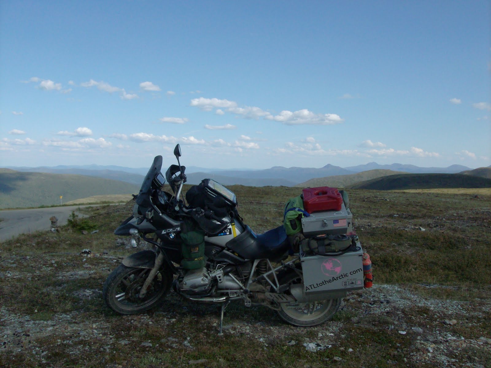 |
Archives
February 2020
|
 RSS Feed
DISCLAIMER | ABOUT | THE ADVENTURE TRAVEL LIBRARY
Copyright © 2010-2023 All Rights Reserved David Giguere | Georgia Overland | Georgia Traverse™
All materials on this site are protected by copyright and intellectual property laws and are the property of David Giguere.
Unless stated otherwise, you may access and download the materials located on www.georgiaoverland.com only for personal, non-commercial use.
You may not reproduce this material on your personal website, blog, social network, or any other online, offline, digital or print resource without permission granted by David Giguere.