|
Georgia Overland Contributor, Randall Warren, is at it again. I received the following information regarding a ride he enjoyed in the Dupont State Forest. And as I stated in earlier posts, since I have neither verified the accuracy of the descriptions nor checked for legal vehicle travel, I feel obligated to state the obvious...Use the following information at your own risk. With that out of the way, I give you Dupont State Forest from Randall Warren: Here's some info on Dupont. It's located in the community of Cedar Mountain off Highway 276. It's about twenty minutes from Brevard, North Carolina and one hour from Greenville, South Carolina. Take Cascade Lake Road off Highway 276. Go about 500 feet and turn right on Reasonover Road. This goes for about 2.5 miles then splits. Pinnacle Mountain Road goes left and Green River Road continues straight. Green River Road is an easy gravel road to drive. It goes for four miles and takes you back to US 25 in North Carolina. It was a little rough due to all the rain but it is just a nice drive through the woods and can be driven in any vehicle. Pinnacle Mountain Road goes into Dupont State Forest. The road is about six miles long. Not too bad going up. When you get to the top there are a couple spots there are a little rough. Good tires and maybe six inches ground clearance should work. The biggest issue is on the top part where there is logging going on. This is about a two mile stretch. They keep it graded pretty good and it's easy going when it's dry. It was a little wet and muddy when I was there today. If it's too wet, you may need 4wd or AWD. I'm going to try to make it back up after a good rain and test it. The views are good, but it's being clear cut and looks barren. Pinnacle Mountain continues on to Hendersonville. Take a left at Sky Valley Road to go back to Dupont. This is another gravel road and it goes for 4.5 miles. Pretty easy going though. Dupont State Forest has over eighty miles of hiking, biking, and horse trails. Some waterfalls and plenty of good views. Plenty of places to park and gain access to the trails. There are two pics of Green River Road. The rest are for Pinnacle Mountain Road. 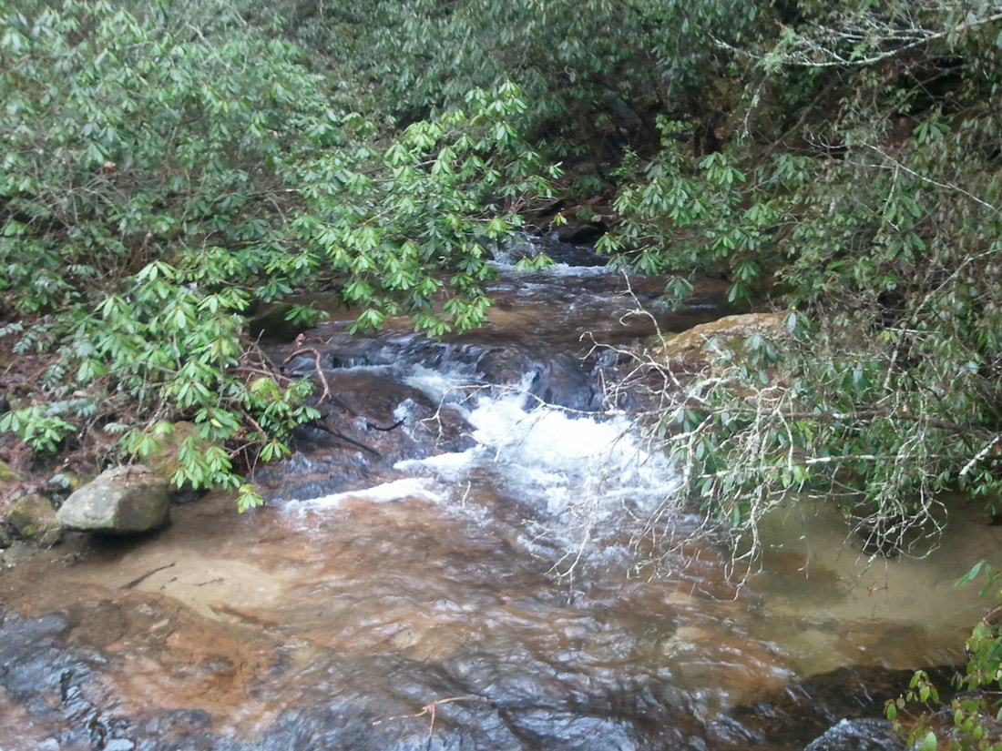 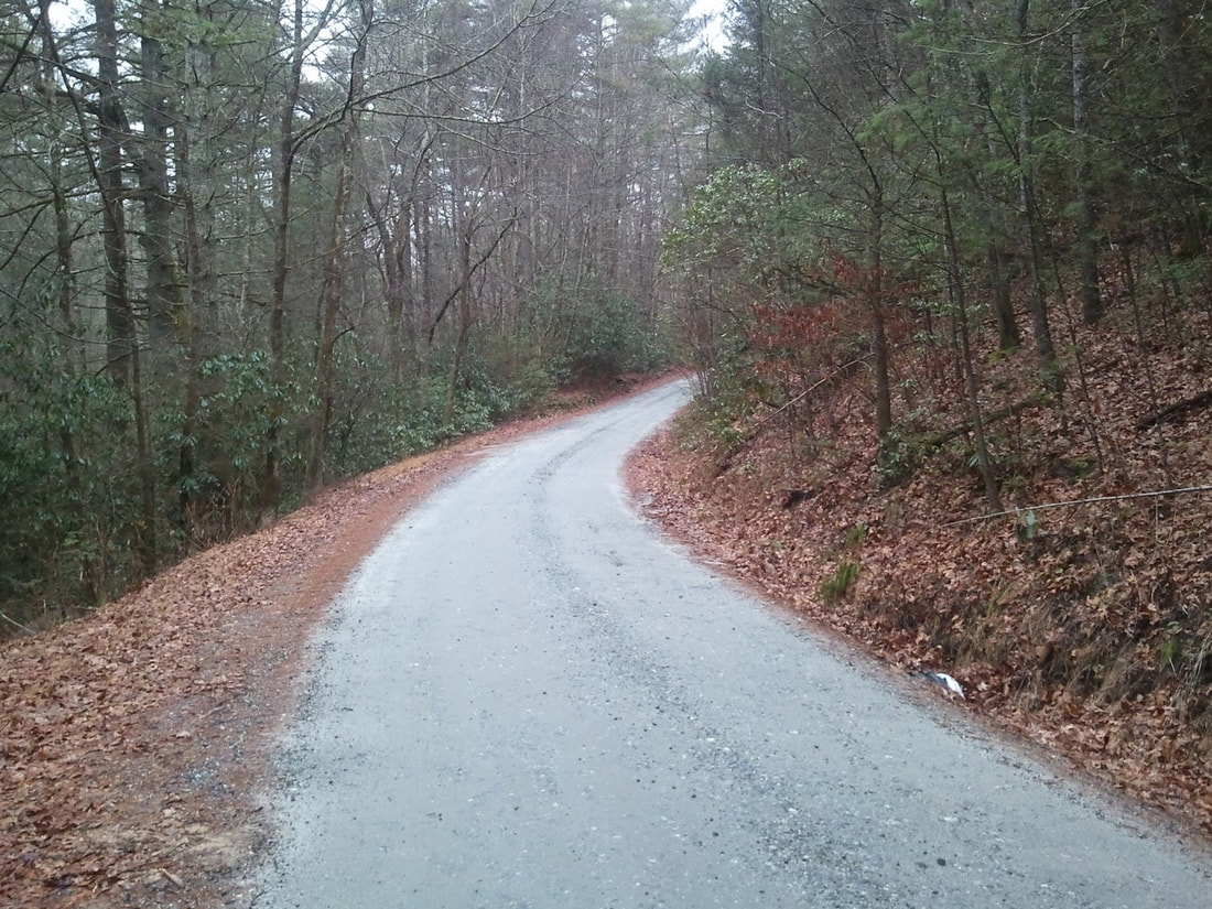 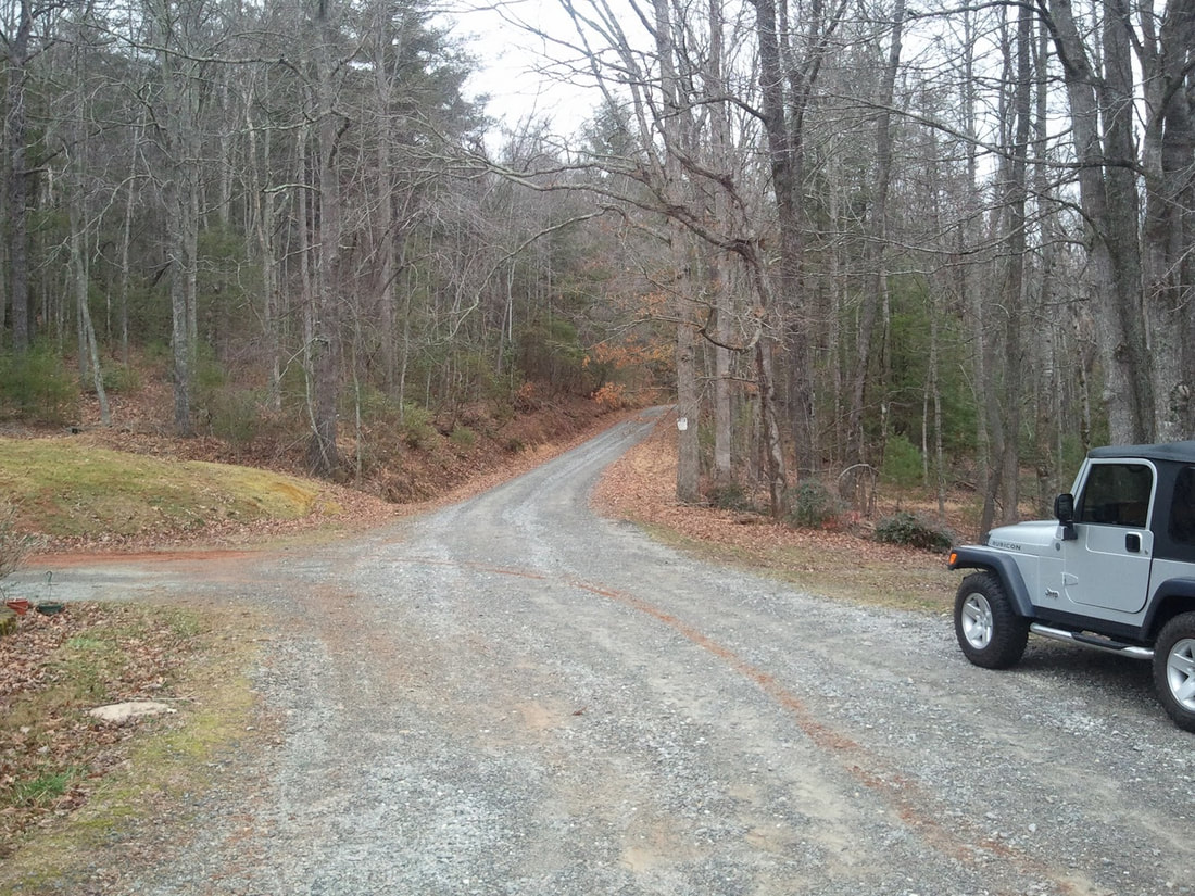 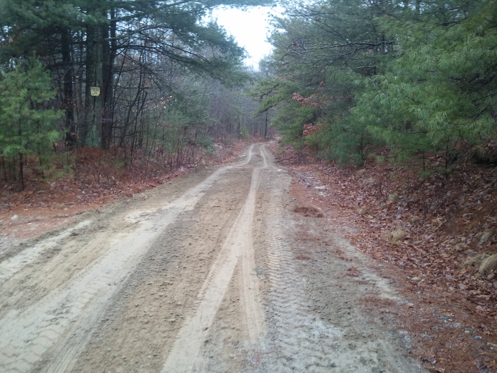 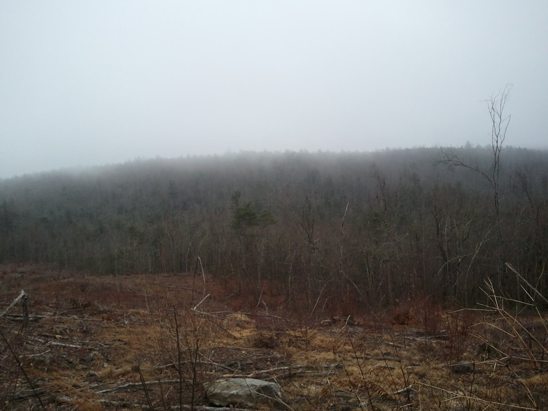 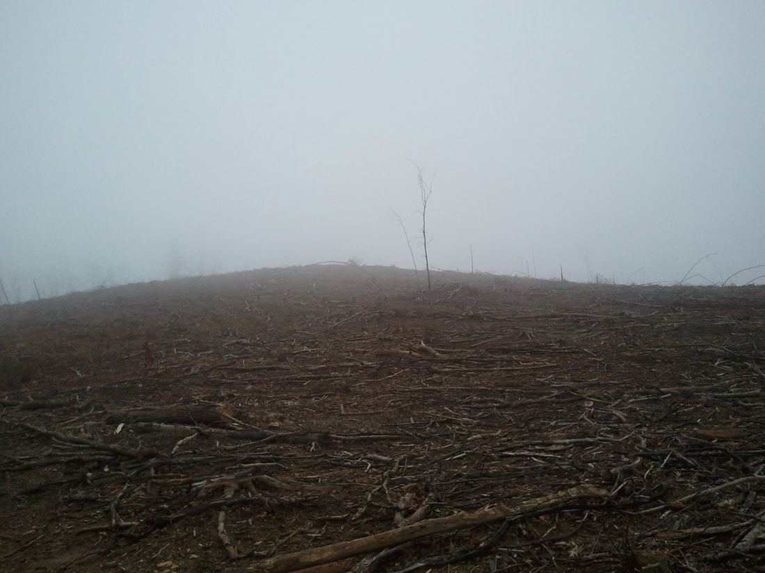 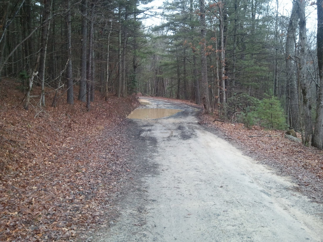 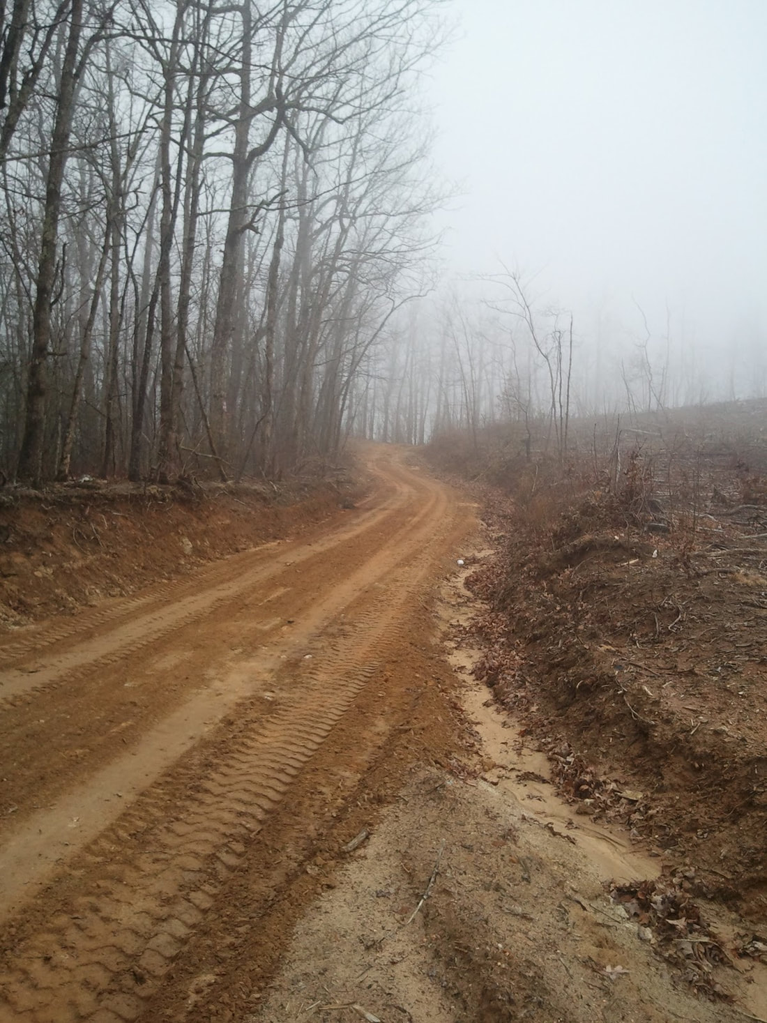 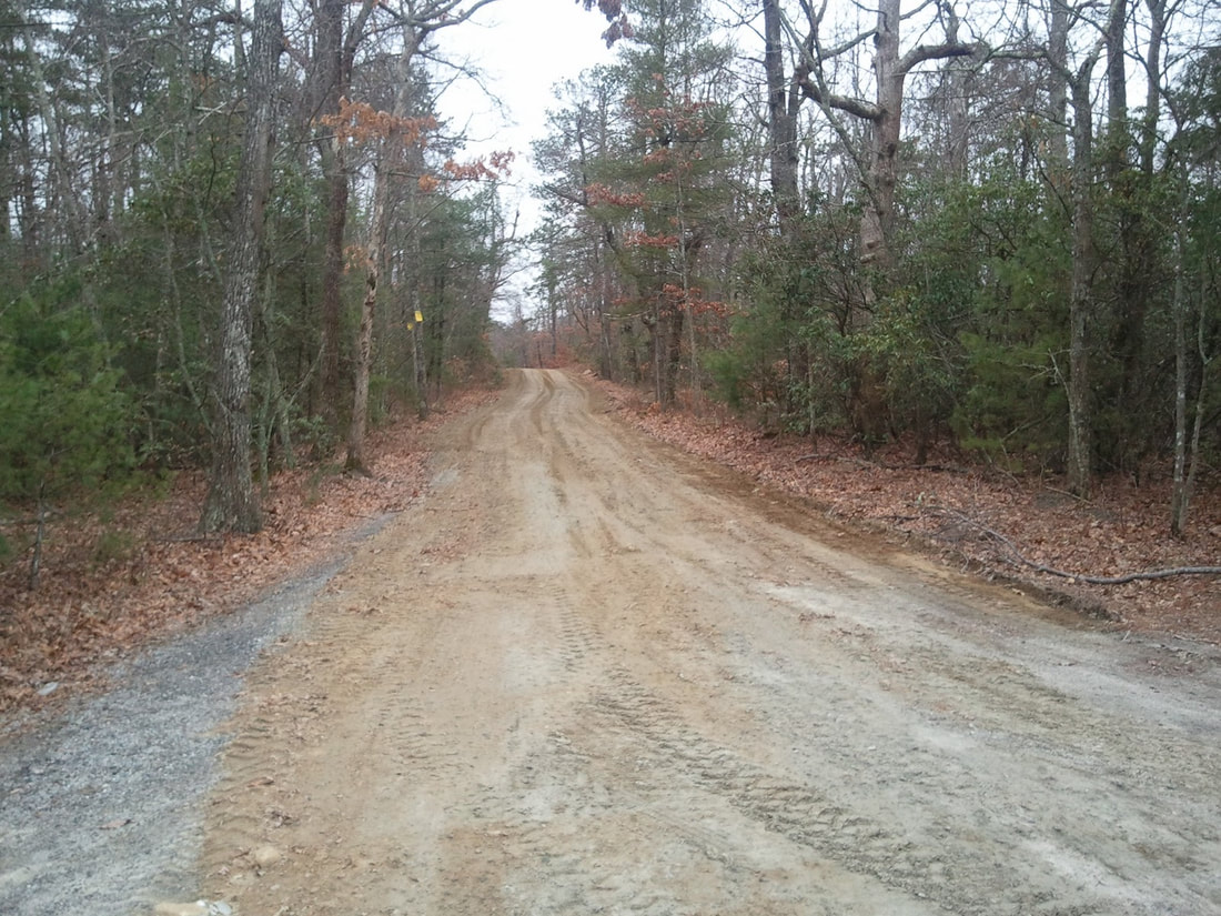 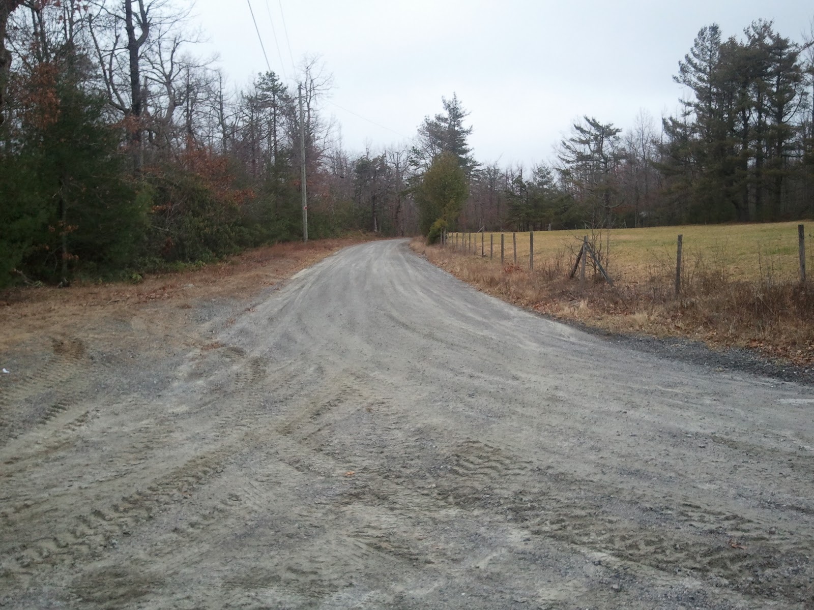 Another option outlined by Randall while visiting this area is: Here is some info on Cascade Lake Road. Instead of turning right on Reasonover Road, you stay straight on Cascade Lake Road for about 4 miles. The road then turns to gravel. This part is about five miles long and is in good shape and can be driven in any vehicle. You have good views of Cascade Lake which is about two miles long, and then the gorge after the water releases from the dam. This road skirts Dupont State Forest and you can loop back into Dupont by turning at Crab Creek Road, or continue on to Highway 64 outside of Brevard, North Carolina. 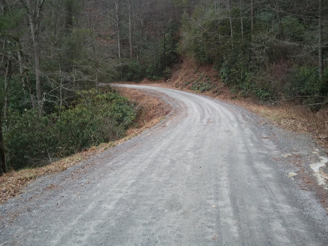 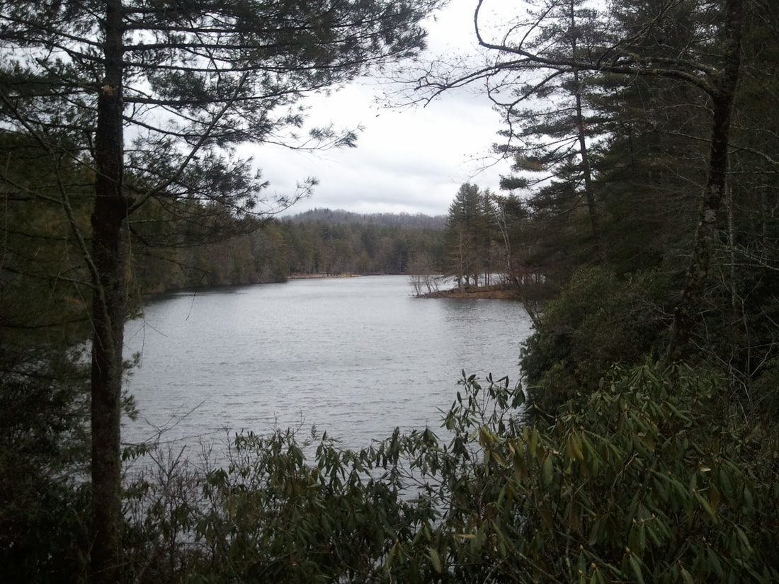 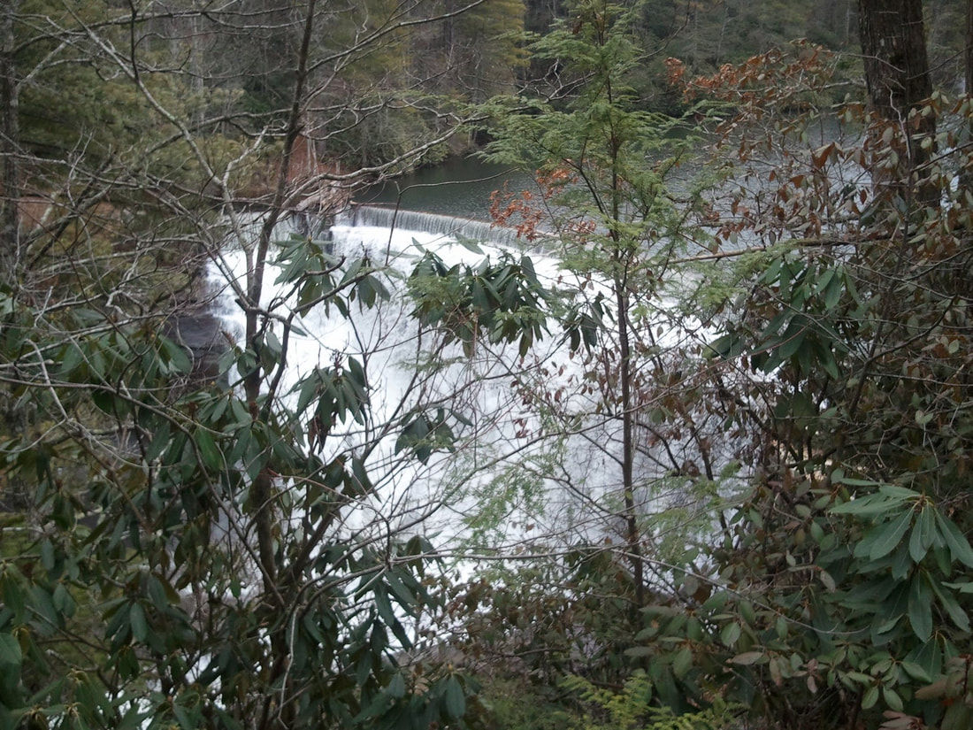 Thanks again for the great information and pics, Randall!
-David This collection of a few dirt and gravel roads is an attempt to capture as many off-pavement opportunities as possible for visitors as they transit between Rich Mountian and the Cohutta and Big Frog Wilderness Loop.
Download the Rich Mountain WMA to the Cohutta and Big Frog Wilderness Loop .kmz file. -David This section connects portions of the previously captured in the West Wolf Creek Rd to Georgia Highway 60 file. It adds portions of road to the Coopers Creek WMA, as well as a remote section of dirt and gravel trail (FS 640 and Old Dial Rd) that runs nearly unbroken from Skeenah Gap Rd in the east, crosses Georgia Highway 60 / Morganton Highway, and continues to the Shallowford Bridge in the west. Also found in this section is the Toccoa River Canoe Launch at Sandy Bottom, a variety of hiking trails, and a waypoint to a really interesting 'Swinging Bridge' found along the Benton MacKaye Trail.
Download the Rich Mountain WMA to Coopers Creek WMA .kmz file. -David I recently heard from GeorgiaOverland reader, Todd S. He included a great picture of his Toyota 4Runner in the Cohuttas, heading up to Lake Conasauga. This really is a beautiful area in North Georgia. Thanks for the email, Todd! 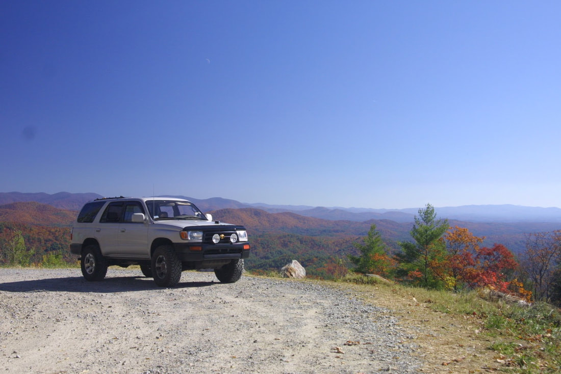 I recently had an email exchange with Randall Warren regarding an area I have yet to visit, the Jim Timmerman NRA. He enjoys the backroads of North and South Carolina in his Jeep Rubicon and offered to share some information with Georgia Overland. Below are slightly edited excerpts from our conversation. Since I have neither verified the accuracy of the descriptions nor checked for legal vehicle travel, I feel obligated to state the obvious...Use the following information at your own risk. About the Jim Timmerman Natural Resources Area: ...Some info on the Jim Timmerman NRA in Jocassee Gorges. Mostly in South Carolina, next to North Carolina. Horsepasture Road is 20 miles long, one way. It has two entrances and great views of Lake Jocassee. It can be done in a Subaru-type vehicle. Uphills are a little rough. There is another road that goes 9 miles down to the lake. Lots of side roads I have not explored. A couple of creek crossings also. I think Musterground Rd is part of this area. It's 13 miles one way. These roads are open Sept 15-Jan 2, and the month of April. http://www.dnr.sc.gov/managed/wild/jocassee/management8.htm About the Gorges State Park (3/23/12 - New Information from Randall below) : ...Info on the Gorges State Park area in NC. Chestnut Mountain Rd. is 3.5 miles. Sign says 8 inches clearance needed. Not bad till you get to the last 1/2 mile. Rocky and steep. Saw a Toyota Highlander there. Not sure it made it back up. The road becomes Bear Creek Rd. back towards South Carolina. You can hit Crossroads Mountain Rd. which goes for a couple of miles. It dead ends and you can walk down to Lake Jocassee. Not sure how far Bear Creek Rd. goes. I went about 3 miles. Auger Hole Rd is also down here. Chestnut Mountain connects to Auger Hole Road. Then Auger Hole connects to Bear Creek. It eventually dead ends at Crossroads Mountain(the mountain, not the road) where there are the two campsites. Info on these type roads is a little sketchy. Website says it eventually hooks up with Musterground. I did these trails when it was bone dry and had no problem. Fairly rocky and steep. Probably need at least 30's and 6 inch clearance. It was a lot of fun though. Couple of campsites out there also. http://www.ncwaterfalls.com/gorges1.htm About Dupont State Park: ...Dupont State Park in NC, just over the border from SC on Hwy 276. Pinnacle Mountain Rd. has some great views and the park has a lot of dirt roads. I have a buddy of mine who rides behind my Jeep on a Kawasaki KLR. Ground clearance is not really an issue on most of these roads. Just having some weight in the back to make it up the steep sections. This is where 4wd comes in handy. About Jocassee Gorges (3/23/12 - New Information from Randall) : Here is a little information and some pictures from Jocassee Gorges (part of the Jim Timmerman NRA). It can be entered from Highway 178 or from Highway 11 by way of Cleo Chapman Rd. There are state parks from one end of Highway 11 to the other. Highway 11 is also a great drive, straight for the most part with views of the mountains and lakes. This website gives more information about the area, and when the backroads are open. http://www.dnr.sc.gov/managed/wild/jocassee/indexfull.htm Randall provided a new map link and this text: If you look at "The Gap" which is east of "LFHP", you'll notice that the road splits. Horsepasture goes left. I haven't been on this. Don't know if it's still open(more research). The road that I labeled as Horsepasture is really Cane Brake, Jackie's Ridge, & Dawkins Flat. Same road, three different names. They meet back up with Horsepasture just before Jumping Off Rock.http://www.dnr.sc.gov/managed/wild/jocassee/map.pdf About Horsepasture Road: Horsepasture Road goes through the Jocassee Gorges area, which is a part of the Jim Timmerman Natural Rescources Area. Horsepasture Road is about 22 miles long. Ground clearance is not really an issue, unless the hills have not been scraped. They had just been scraped when I was there yesterday, but last year they were pretty deep. Good tires are needed to make it up the hills. 4wd or AWD would be helpful for making it up the hills. Not technical, just steep. The rest of the road is pretty easy. There are also a couple of creek crossings. There are a few campsites and a couple of side roads. One I explored was called Schoolhouse Rd., 2.5 miles until it dead-ended. A little more technical than Horsepasture, but nothing serious. There are miles of roads that are 'red gated' (permanently? closed). I ran into a couple of old timers who told me that you used to be able to go all the way to Cashiers, NC on the roads. All of the red gate roads are open for hikers and mountain bikers. The highlight of the trip is Jumping Off Rock. There are great views of the lake and the mountains. This is near the halfway point of the road, depending on where you start. This road continues on for nine miles down to the lake, where there is a boat dock. This road has some rough spots as you are coming back up. There are also a couple of Heritage Preserves on the road, and the Foothills Trails passes through. The pictures I have provided are in order from the time I entered the road from Highway 178. The photos of the lake and mountains don't really translate how good the view is. Even though it was cloudy, it was still awesome. 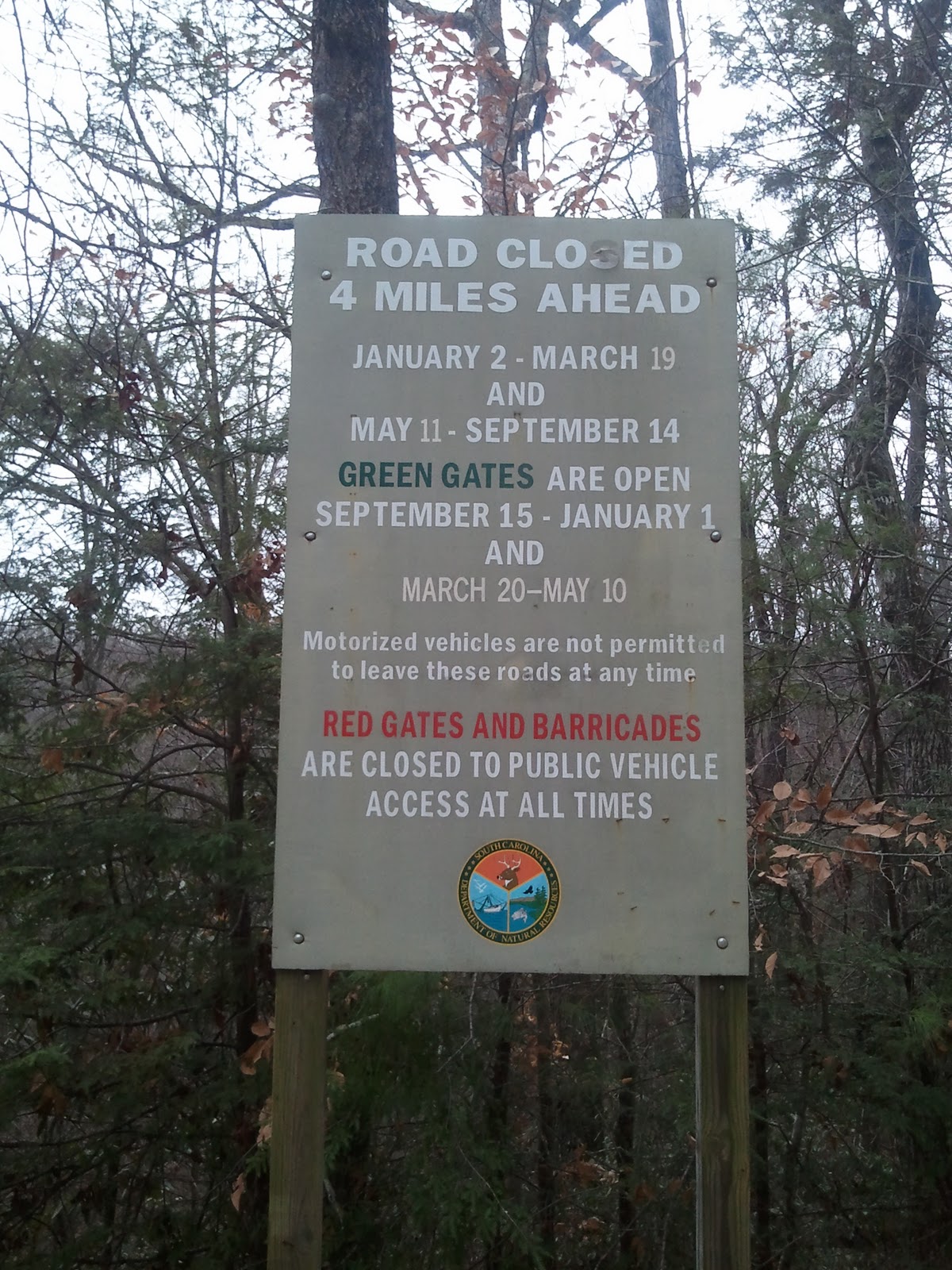 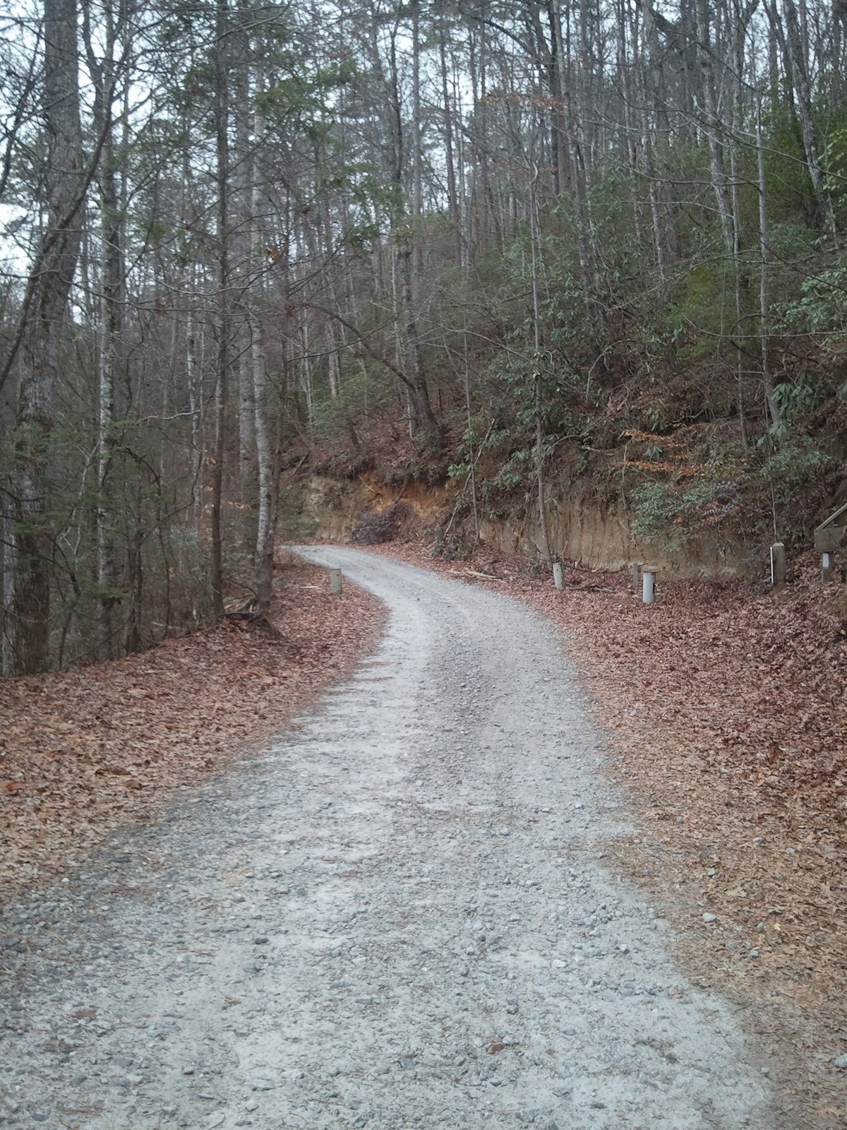 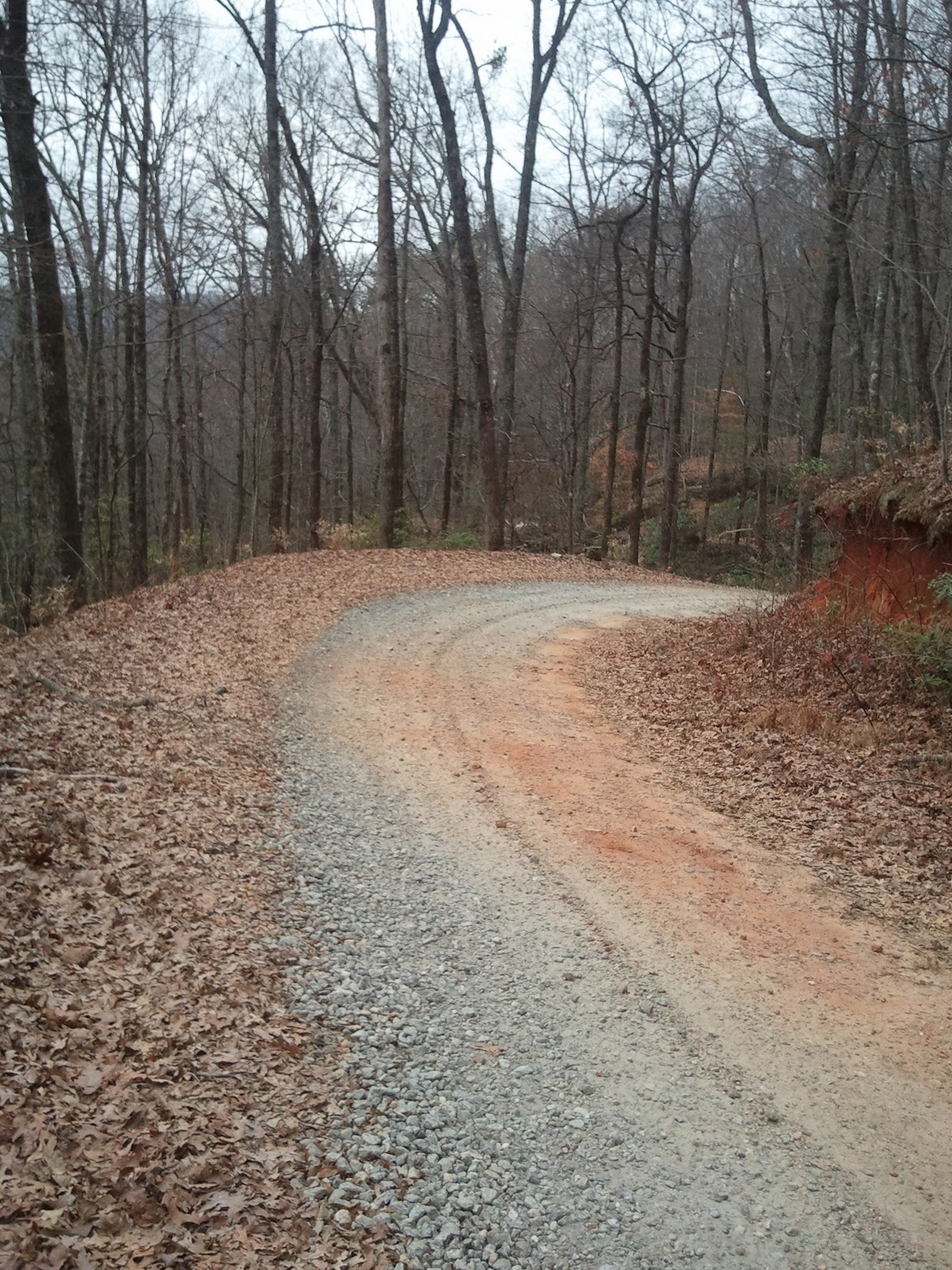 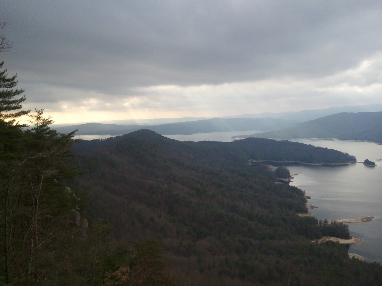 Additional Comments: ...If I can make it up to the Musterground area before it closes on January 2, I'll send you that info. The Gorges SP area in NC is open year round, and I can update that the next time I'm there. I will also send you the info on Dupont State Forest area. There are over eighty miles of trails, and a lot are dirt roads. Pinnacle Mountain Rd. is here, and Green River Rd. splits off from this. There is also FR475B north of Brevard. These are all roads I drive on in the summer to escape the heat of SC. I'm sure there are many roads in the SW corner of NC that I haven't found yet. Additional Pics from the Area: 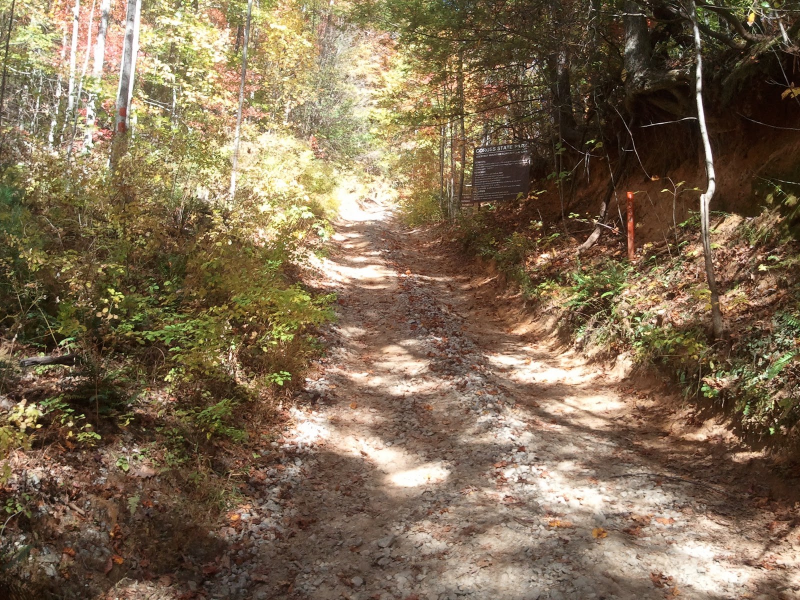 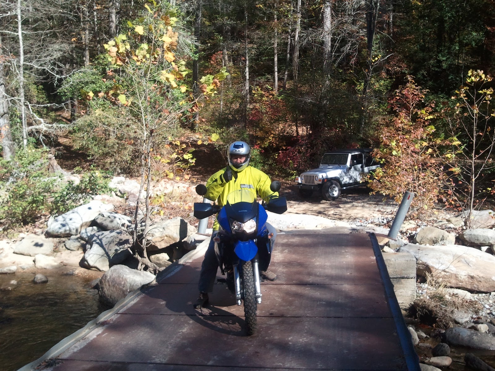 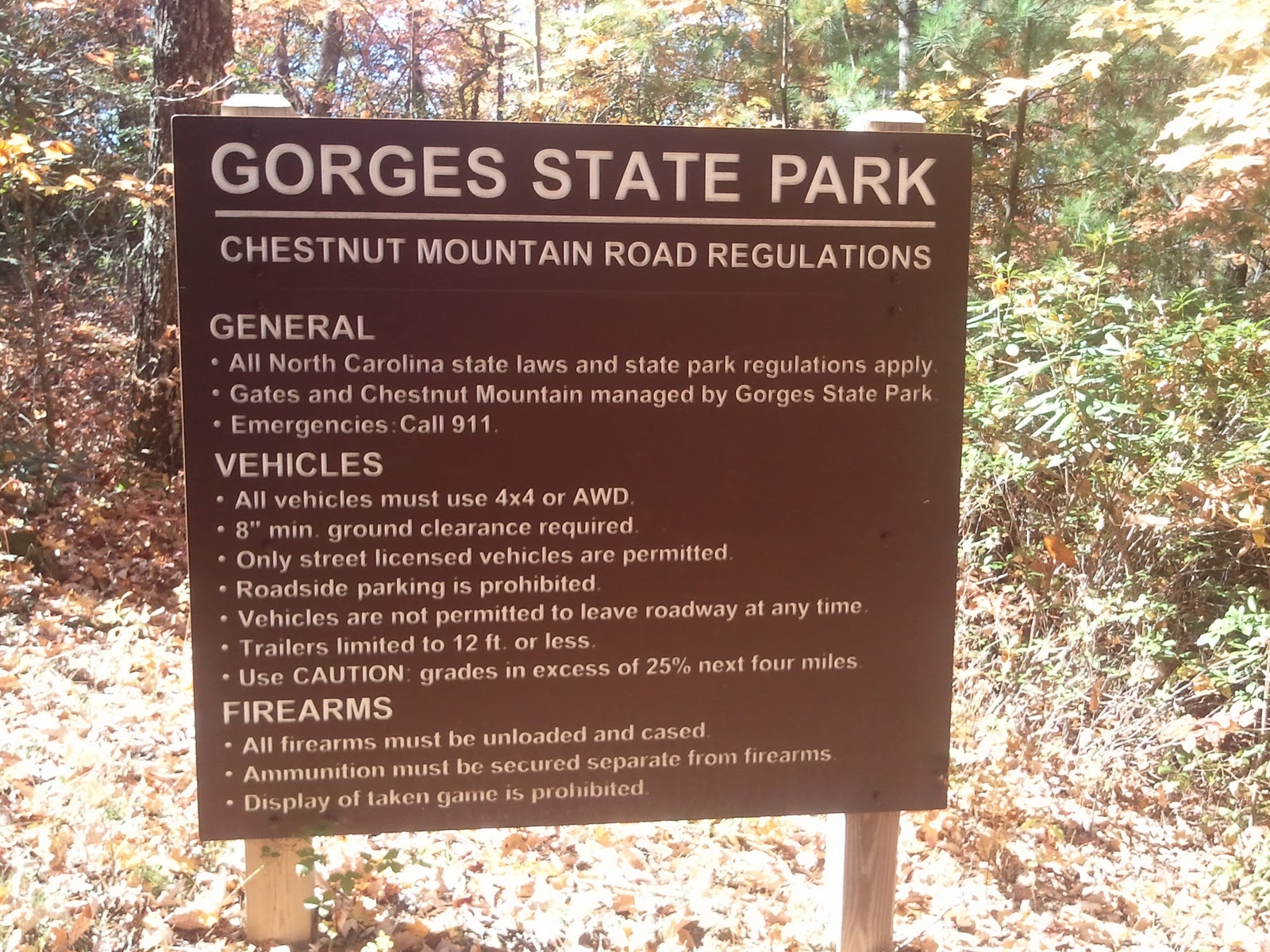 I owe Randall a big 'Thank You' for taking the time to share so much information. If you, the reader, have any information to add regarding this or any area in the region, shoot me an email.
I received an email from a new Georgia Overland visitor, Nathan at Boxerworks. For those riders near the Watkinsville, Georgia part of the world, check them out...
Boxerworks Any Part - Any Service - Any Bike Details: Phone 7AM - 5PM: 706.310.0699 Breakdown Service: 706.614.4698 Email: nathan@boxerworks-service.com Shop: 1461 Greensboro Hwy, Watkinsville GA 30677 GPS coordinates: N 33º 51.091 W 083º 23.769 Thanks for the email, Nathan! I had a chance to drive a few sections this weekend. Picking up where I left off in the Coopers Creek WMA and working my way west into the Rich Mountain WMA. Stay tuned!
-David Hatchet Creek Rd and Helton Creek Rd may be used as a convenient dirt road shortcut between Georgia Highway 348 / Richard B Russell Scenic Highway to the east and US Highway 19 / Gainesville Highway, to the west. When passing through, be sure to stop and take a quick walk down to the picturesque Helton Creek Falls.
Download the Hatchet Creek .kmz file. -David This dirt and gravel road network is found north of Unicoi State Park, near Helen, Georgia. This area is roughly bound by Georgia Highway 17 to the west, US Highway 76 to the north, Georgia Highway 197 to the east and Georgia Highway 356 to the south. Found within are a number of designated areas including the Swallow Creek WMA, High Shoals Scenic Area, Tray Mountain Wilderness, Anna Ruby Falls Scenic Area and the Lake Burton WMA. Additionally, the Appalachian Trail passes through this beautiful wilderness. For the road network in the Lake Burton WMA and portions of the Tray Mountain Wilderness, please see Section 2 of the Tallulah River Rd to West Wildcat Creek Rd file, Dicks Creek to West Wildcat Creek Rd. Nearly all the roads in the network are passable with car in a normal automobile. A high clearance vehicle is not likely required, except for one section. The section of Tray Mountain Road located between Corbin Creek Road and Chimney Mountain Road is quite rough. A couple miles of smaller rocks and boulders will bring you and your vehicle to a crawl. While the rocks are not large, they are plentiful and they may create problems for many AWD vehicles. As a result, I recommend a higher clearance vehicle with some form of underbody protection (skidplates).
Including the 'out and back', deadend distance of Mill Creek Rd, the entire drive was nearly 40 miles of dirt and gravel roads with over 50 waypoints collected. This is a nice area to drive, with many hiking opportunities available. Download the Swallow Creek WMA.kmz file. -David I'm behind on getting the new route data cleaned up. I'm also making a few changes to the way I displayed older data. Hopefully, the changes I make now will help when I produce the final route map.
As it stands, I believe I will have the majority of the route wrapped up early 2012 and the plan is to have a proper, hard copy Georgia Overland route map printed and available by Fall 2012. Stay tuned... |
Archives
February 2020
|
 RSS Feed
DISCLAIMER | ABOUT | THE ADVENTURE TRAVEL LIBRARY
Copyright © 2010-2023 All Rights Reserved David Giguere | Georgia Overland | Georgia Traverse™
All materials on this site are protected by copyright and intellectual property laws and are the property of David Giguere.
Unless stated otherwise, you may access and download the materials located on www.georgiaoverland.com only for personal, non-commercial use.
You may not reproduce this material on your personal website, blog, social network, or any other online, offline, digital or print resource without permission granted by David Giguere.