|
It's been more than a year since I posted my thoughts on this great app for the iPhone and I continue to use it for all my GeorgiaOverland.com trail capture. Numerous revisions, updates and improvements have brought us to v15.2 and it is now, for a limited time, ONLY $.99. Unbelievable. Buy this app today. You cannot beat this app and for only a buck you cannot beat the price, or the customer support. I have contacted them numerous times and they are always responsive. In fact, they have taken an interest in our humble little project here at GeorgiaOverland. Stay tuned for more details...
A few highlights included in the latest version:
-David A better title might be: How I managed to drive quite a few miles and still did not find the elusive route across the Chattahoochee National Forest between Highway 76 / Highway 2 and Highway 75 / Unicoi Turnpike...but that is just too long.
Keep in mind, this trip contains a number of paved miles that are not represented in the .kmz. Notations are made when pavement is reached, but the user should consult a good map to find the paved roads that connect the dirt and gravel sections. The first section of the Tallulah River Road to West Wildcat Creek Road route begins at the water crossing off Tallulah River Road, providing access to Charlies Creek Road. This section is approximately 8 miles of dirt and gravel road and includes a couple miles of dead end / return trip side road travel. Pavement is reached at Upper Hightower Creek Road. After traveling briefly on Upper Hightower Creek Road, a turn on to Barefoot Road yields a short section (< 1 mile) of dirt road and ends at the intersection of Barefoot Road and Hwy 76 / Hwy 2. The second section consists of approximately 21 miles of main and side trails including, but not limited to, Dicks Creek and West Wildcat Road in both directions. I began this trip with two goals in mind. First, to retrace previous drives across the Tallulah River Road to Upper Hightower Road portion and confirm that it is still open. The second goal was to find a complete and open route across the Chattahoochee National Forest between Hwy 2 / Hwy 76 to the east and Hwy 75 / Unicoi Turnpike to the west. At the time of this trail collection, the route across the Chattahoochee National Forest is not open, though it may be possible. West Wildcat Road ended at a closed gate. I need to follow up with the Chattahoochee National Forest stewards and attempt to secure permission to continue on through the gate. I suspect that it is closed year-round, but only contacting the Chattahoochee National Forest will confirm this to be the case. Download the Tallulah River Road to West Wildcat Road.kmz file. -David Yes! My good friend Daniel and his friends are making the trip from Atlanta to the furthest reaches of the Dalton Highway to raise money for the Susan G. Komen fund. Interested? Need more information? Want to ride along?! Please visit his site... www.atltothearctic.com 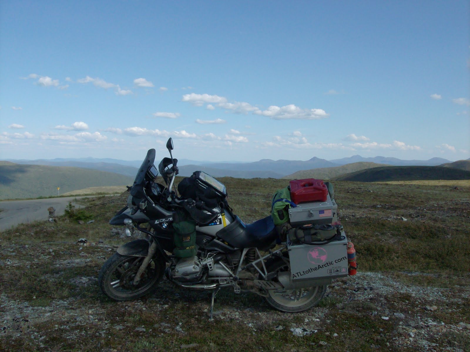 Note: The Patterson Gap Road to Tallulah River Road route can either be a scenic ride to Tate City and back, or it can be a portion of a longer route that connects to Upper Hightower Creek Road via Charlies Creek Road. The Tallulah River Road to Upper Hightower Creek Road trail is complete and will be available as soon as I finish preparing the data.
Traveling North into Dillard on Highway 441, turn left on Bettys Creek Road. This route begins at the intersection of Bettys Creek Road and Patterson Gap Road. The route includes approximately 32 miles of track and 43 waypoints. Of the 32 miles, a number of miles are return trip or dead end miles. For instance, the drive to Tate City on Tallulah River Road yields a dead end, you must backtrack. Also, a few side trails are backtracked. The most interesting portion of this drive is the Abe Gap Road / FS 32C connector that allows travel between Patterson Gap Road and Coleman River Road. A number of maps I have (including Google Maps) do not show this road as connecting. Be aware, this section is remote and rarely traveled. If you do not have a high clearance and/or 4wd vehicle, I would recommend bypassing the Abe Gap Road and Coleman River Road portion of this route. Instead, continue on Patterson Gap Road (rather than turning on Abe Gap Road / FS 32C) until it meets Persimmon Road. Take Persimmon Road to Tallulah River Road, providing access to Tate City and the Charlies Creek Road to Hightower Creek Road route. Download the Patterson Gap Road to Tallulah River Road and Tate City.kmz file. -David |
Archives
February 2020
|
 RSS Feed
DISCLAIMER | ABOUT | THE ADVENTURE TRAVEL LIBRARY
Copyright © 2010-2023 All Rights Reserved David Giguere | Georgia Overland | Georgia Traverse™
All materials on this site are protected by copyright and intellectual property laws and are the property of David Giguere.
Unless stated otherwise, you may access and download the materials located on www.georgiaoverland.com only for personal, non-commercial use.
You may not reproduce this material on your personal website, blog, social network, or any other online, offline, digital or print resource without permission granted by David Giguere.