|
The Route
I've been quite busy with a lot of non-Georgia Overland, non-offroad activities with the family. I apologize to all my readers for not getting the data wrapped up and publishing the final route. I still have much to do...but it WILL get done. Once I make a final, complete pass of the route I can provide all of the exact route distances. Until then, please enjoy the .kmz files available for download on the Maps and Downloads page. GPS Usage I receive many emails from readers regarding route and device suggestions. I wanted to pass along a few course offerings at the Buford REI (other locations have similar offerings) that may be useful. If you enjoy using your GPS device while traveling the backroads of Georgia, but are not completely comfortable with it, you may want to give the GPS Navigation Basics class a try. And if you happen to be one of the many Garmin device owners, you may want to check out the GPS & Computer Class: Utilizing Garmin's Mapping Software. The complete Buford REI class and event calendar is found here. I should also add that I strongly encourage everyone to take a map and compass navigation course just to have a basic understanding of how to use a map (you do carry a map with you, don't you?) and compass (pack one of those, too). While a GPS is extremely useful, they are not foolproof and still rely on batteries and/or external power. Take care, David Well folks, the route is still not wrapped up and I've been busy enjoying life. Back in June I mentioned the final scouting trip to areas west of the Cohutta Wilderness. I'm rather disappointed in what I found and I'm now left with a dilemma. I originally intended to build an off-pavement route across the northern section of Georgia but I'm finding the gaps between pavement and non-pavement are a bit too large to consider for the route. Do I link together the bits and pieces of dirt and gravel road, even if there is an undesirable amount of pavement, just to complete the route 'across' Georgia to Alabama? Or, do I end it on the west side of the Cohuttas and be done with it? Anyone have any thoughts on this? I'm also now considering the creation of a loop into Tennessee and North Carolina, rather than the East-West route I initially intended. Why not? Loops are more fun, right? Stay tuned and maybe, just maybe, I will get this finished up with a nice set of cleaned up .gpx/.shp/.kmz files to share with everyone. And perhaps, a fancy printed map too. -David Another reason I have not made more progress is I choose to squander my time doing fun stuff. Here's a few pics from the 2012 Overland Rally...  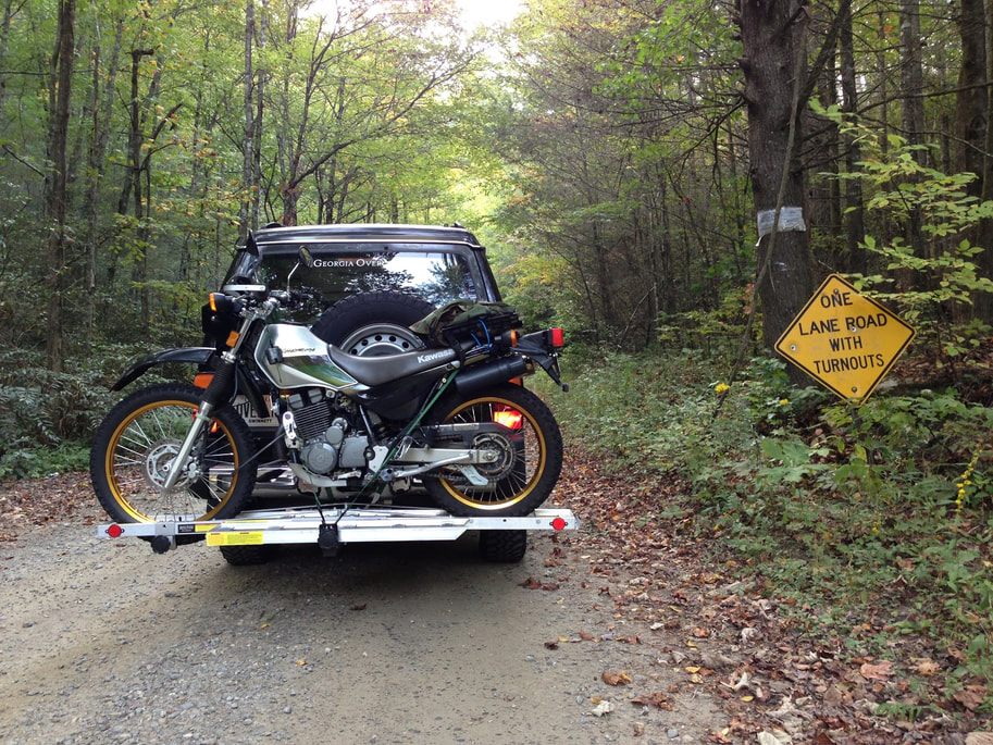 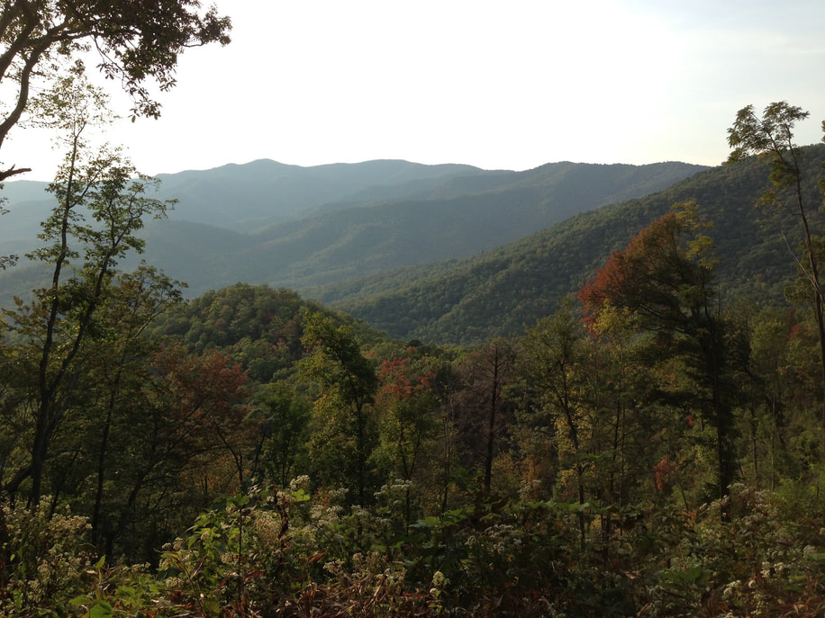 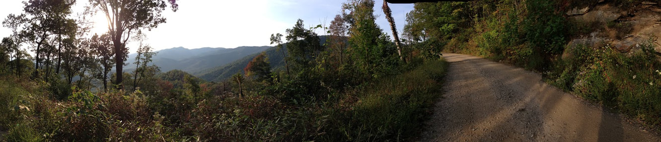 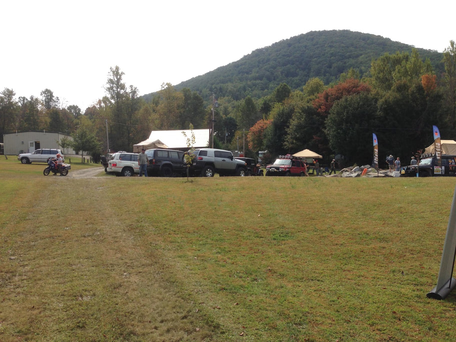 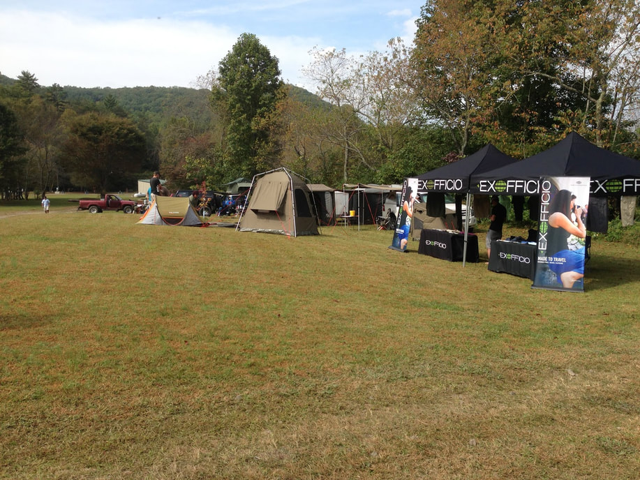 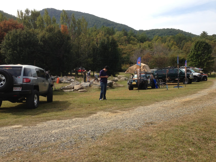 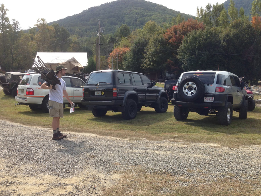 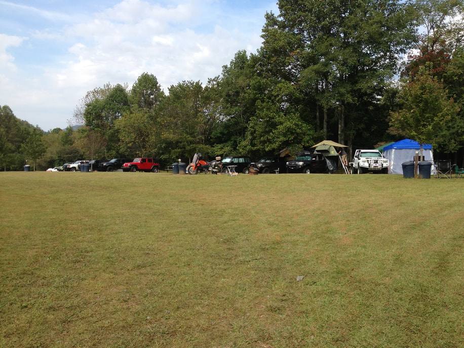 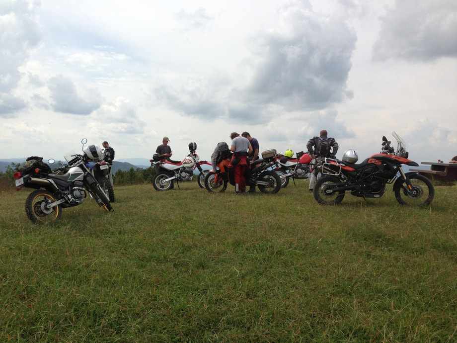  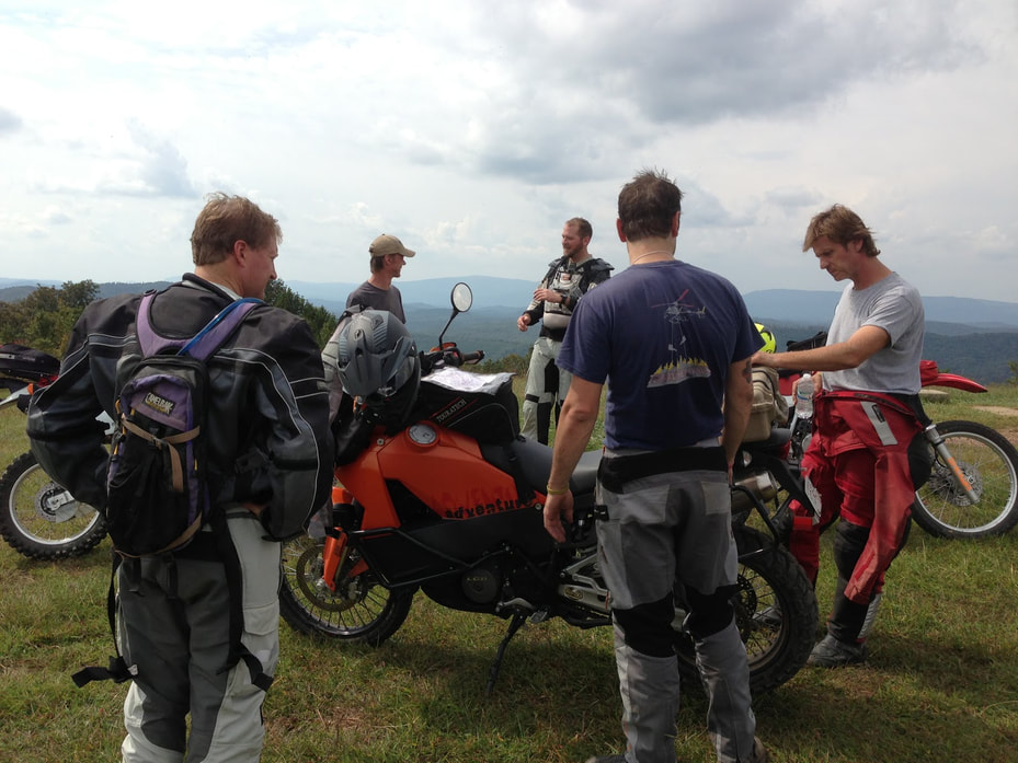  Come on out for a great weekend of camping and workshops while meeting offroad and travel enthusiasts.
-David The Overland Rallies and Workshops aim to bring overland and expedition travel enthusiasts together. The event embraces all skill levels of vehicle-based adventure travel and a multitude of vehicles, trucks, 4x4, dual-sports motorcycles, bicycles and more. The Rally is a family and pet friendly event focusing on training and camaraderie, promoting safe and environmentally sustainable adventure traveling off the beaten path in the US and abroad. Classes: •Basic 4WD •Advanced 4WD •Spotting •Synthetic winch line repair •Motorbike long trip preparation •Motorcycle Trail riding technic •First aid •Spanish phrases for your trip and dos and don’ts in Latin America •Photography •Knots and other fun and useful outdoors stuff for kids Round Tables Discussions: •International traveling, border crossing •Traveling with kids •List to be continued Evening Presentations:
http://www.overlandrally.com/Overland_Rallies_and_Workshops/Register.html Questions: E-mail to [email protected]
Hello Georgia Overland friends,
I invite you to come on out to Decatur Garage (my friend Daniel Palazzolo's shop) on Sunday, August 26th at 8pm for a special free screening of an amazing film, One Crazy Ride. Bring a chair and beverage and join us in supporting the work of our very talented filmmaker friend, Gaurav Jani. One Crazy Ride and Riding Solo to the Top of the World DVDs will be available for purchase as well. The official announcement and film trailer are below. For more information about his films, visit http://dirttrackproductions.com/ We hope to see you there! David 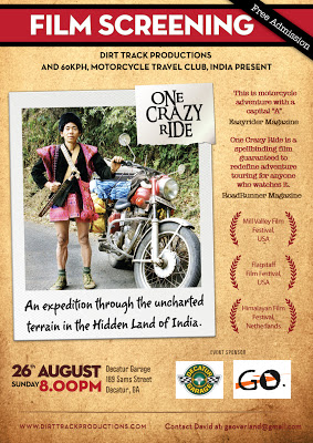
I received a trail report for the Old Bucktown Road and Nimblewill Gap Road area from Larry C., owner of a very nicely modded 2009 Hummer H3T. You may recall seeing his rig before as Larry previously sent a pic of his H3T in the Cohuttas. His H3T has the Adventure package, which includes front and rear locking differentials, 4.10 gearing and Hill Start Assist. He added a 2" torsion bar crank in the front, 1" shackle lift in rear, 35" Toyo Mt's, Rancho Shocks, Trail Duty Extended Bump Stops in front, UCP, Rolling Lock Bed Cover, removable Tire Carrier, Cobra 75 WX ST CB Radio and he will be adding a winch soon. I can't wait to see the H3T in person! Larry's report and images are below. As usual, I'm adding this to all reports... Since I have not verified the accuracy of the descriptions, I feel obligated to state the obvious...Use the following information at your own risk. Now, on to the report. Larry writes: I went up and ran Old Bucktown Road, Forest Service 46 out of Amicalola Falls State Park, and Nimblewill Gap Road today. Here's a few pics and a brief description of the route I took. I initially wanted to start on Old Bucktown Road but lost cellphone coverage and my Google Map went down so I missed the turn. Instead, I started in by going to Amicalola Falls State Park and headed up High Shoals Road / FS 46, there the road starts off paved and turns into gravel once you pass the last set of cabins in the park. For this section of road a high clearance vehicle is recommended as there are some deep ruts and puddles, but nothing too major where major modifications are needed. This roads goes for about 3-4 miles and it looks to have been graded within the last year or so which made its pretty easy going, but bumpy.   After traveling FS 46 for a short time you eventually come out at the junction of Old Bucktown Rd and Nimblewill Gap. At this point I chose to take the right and check out Nimblewill Gap Rd. Surprisingly the road is in very good condition with hard packed gravel, the Forestry Dept. must have just graded it because it was easy to go 20-25 mph at some points. You could even take a car on it driving slowly.  At the junction of Old Bucktown Road, FS 46 and FS 28-2 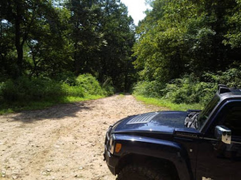 Turning onto Nimblewill Gap Road About 5.3 miles of Nimblewill Rd is gravel, three miles of which is hard packed rocky gravel and 2 miles is packed Pea Stone which forms a loose pavement, then the last 5 miles is straight, smooth pavement. The total road length is about 11 miles. 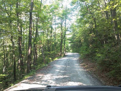 Nimblewill Gap Road 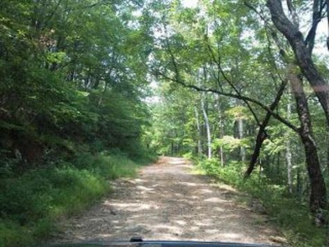 After I got to the end of Nimblewill Church Rd I still had more time for exploring so I turned around and went back up Nimblewill Gap Rd to the junction where FS 46, FS 28-2, and Old Bucktown Rd meet. I went down Old Bucktown Rd, and as you had said the road had been graded sometime recently. You will need to have a high clearance vehicle because it is very rocky and when raining it will be very muddy and will have water running across the road from runoff coming down the mountain. 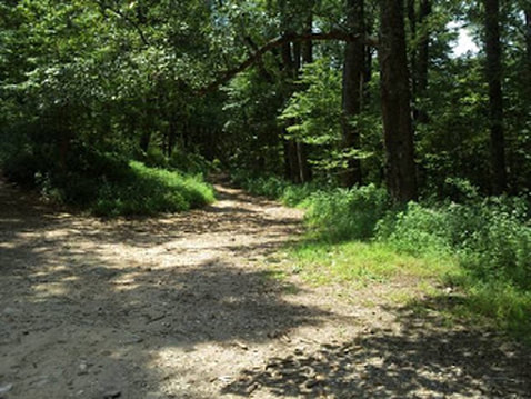 Beginning of Old Bucktown Road 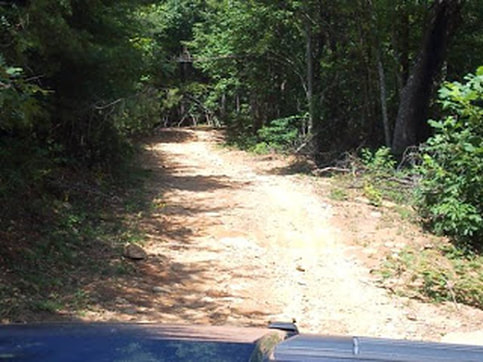 Old Bucktown Road About 3.2 miles of Old Bucktown Road is rough gravel and after that the rest (approximately five miles) is paved right up to Roy Rd. All in all it is a nice easy ride. In the Fall the views should be pretty spectacular once the leaves fall off the trees because there is a view of the valley for most of the ride. 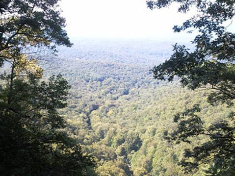 I hope this info comes in handy to someone, hope to have more soon. Best regards, Larry
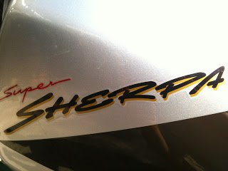
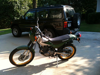
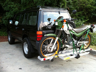
Thank you very much, Larry, for taking the time to write the report and send the images. I'm certain it will be useful to Georgia Overland readers. -David Last weekend marked the final Georgia Overland trail scouting trip for the East-West route across North Georgia. As I anticipated, the off-pavement opportunities are reduced west of the Cohuttas and I am still debating whether to establish the 'end' of the route along the west of the Cohutta and Big Frog Wilderness Loop or to continue the route across a fairly lengthy section of pavement (Eton, Georgia to Johns Mountain WMA) so that I may include dirt and gravel roads along Taylor Ridge. Over the coming month I will review and format the data captured in this final trip and begin to assemble the complete East-West route in the Fall. Stay tuned! 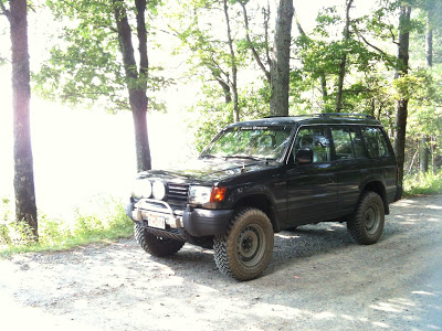 The Georgia Overland 1997 Montero at the Mill Creek Overlook, near Lake Conasauga Campground. After a decade of telling myself "maybe one day", I finally took the plunge and purchased my first motorcycle. Meet the 'new' Georgia Overland 2000 Kawasaki KL250 Super Sherpa. Now I just need to learn how to ride it! Thanks to generous friends (Daniel and Bryan), I have a helmet and jacket and soon I will pick up the necessary gloves, pants and boots. And then the real work begins when I take the motorcycle safety course and begin to figure out this new two-wheel world. -David
My friends at ATL to the Arctic are back at it again for the 2012 ride. This ride for breast cancer awareness and support is now in its third year with two new riders (Gary Lewis and Galen Evans) taking on the challenge of riding from Atlanta, Georgia to Alaska.
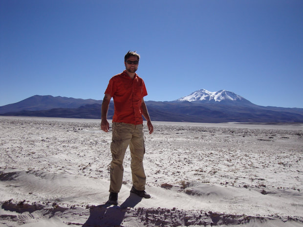
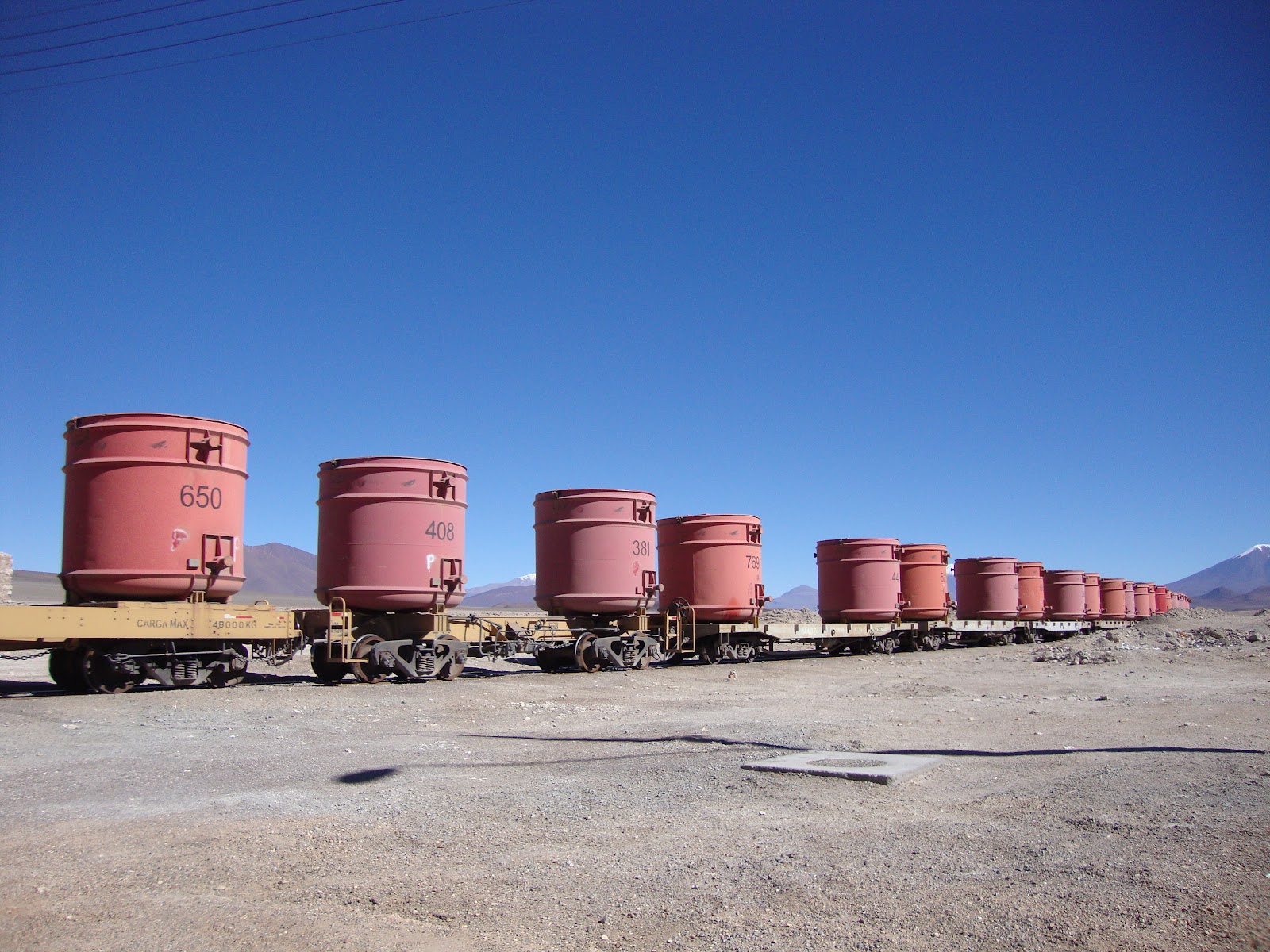
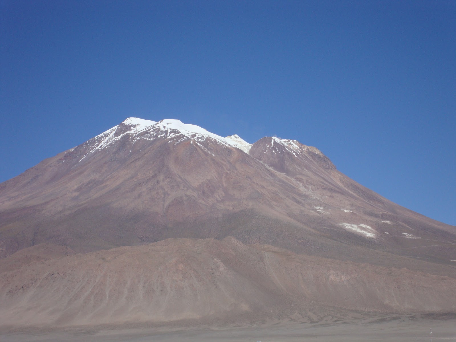
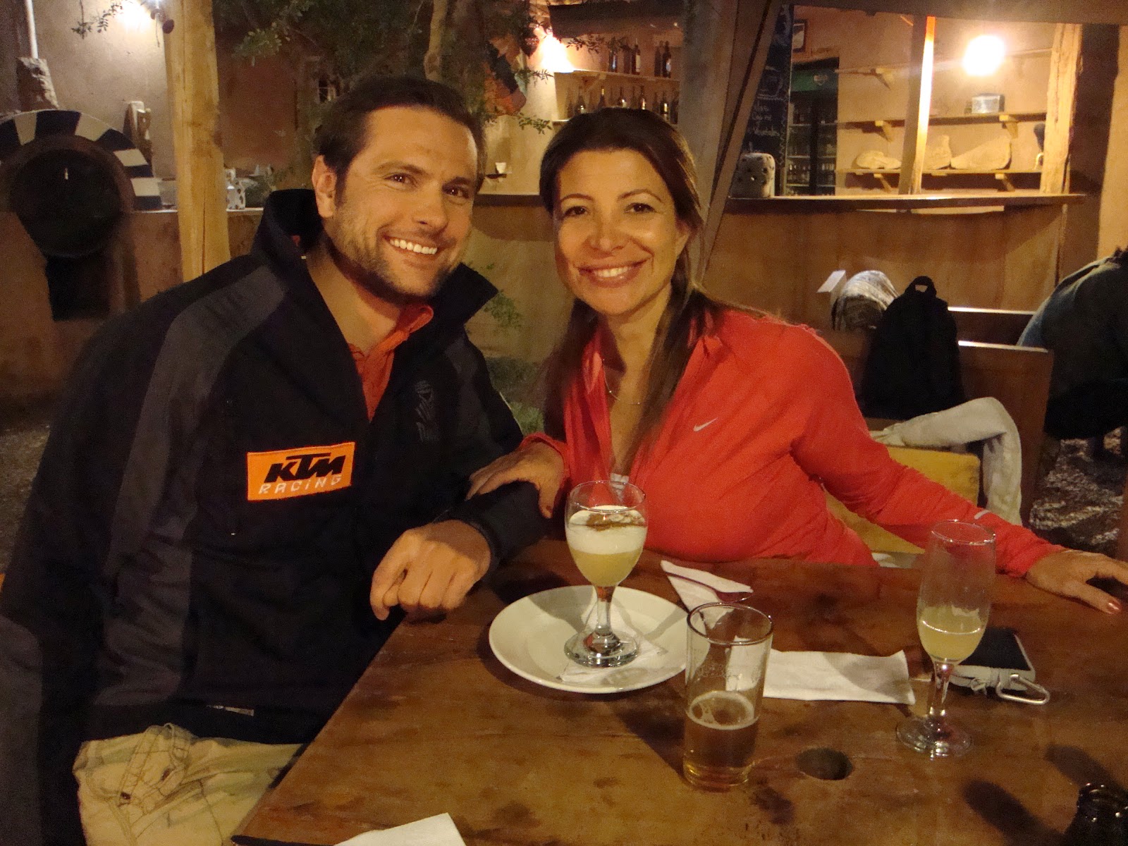
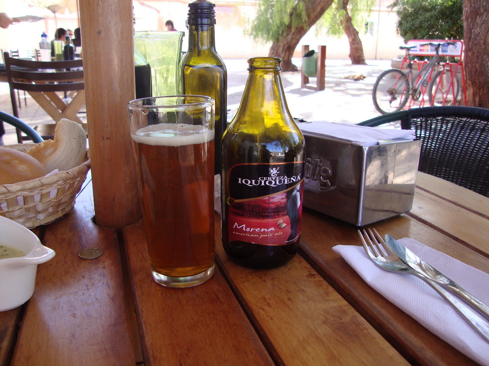
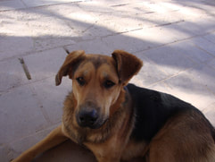
Visit the blog here and donate directly to Susan G. Komen Passionately Pink for the Cure here. Safe travels to Gary and Galen! -David My good friends, Daniel and Paula, recently rented a Hilux and explored the sand and dirt tracks of Northern Chile. A flight into Iquique, a drive to Pica and they were off into the lands unknown, traveling through the Atacama Desert along the way. Daniel sent the following account of their visit to share with the Georgia Overland readers. Enjoy! -David About Paula and Daniel As I sit in Paula's Santiago apartment and look out over the Andes, I try and remember all the small details of the last four days we spent in the Atacama, the driest desert in the world. I'm still a little tired from our overnight flight from Calama, Chile, back down to Santiago. First off, let me tell you a few words about myself. My name is Daniel (Ed. note: his screen name is zolo on the ExpeditionPortal.com Forums) and I have been friends with David a while now. We met a couple years ago, before my motorcycle trip to the Arctic Circle and Deadhorse, Alaska (Ed. note: visit ATLtotheArctic to learn more about this fantastic ride for the Susan G. Komen Fund). Since David has been to the Arctic Circle a few times, he was a good resource for information and maps. Since then, we have been friends and I have been a big supporter of Georgia Overland. I like the site, the maps and the idea of remote off-pavement travel. Now about Paula, my beautiful Chilean girlfriend or polola, as they say in Chile. A world traveler, she has visited the Galapagos Islands, Easter Island, New Zealand and Australia, as well as traveled all over South America, Central America and Europe. She is a High School Biology teacher in Santiago, Chile. Her sense of adventure is great and we have a lot of fun bounding around Chile. We have also traveled together in the US. With her relaxed, adventurous spirit, Paula is nice to travel with. She also has a knack for picking out the good places to eat and drink. And when the times are rough, like when we had a wheel bearing failure on my Tacoma in the middle of Texas, the day before Christmas, she didn't even balk. What a woman! Iquique to Pica We left for Iquique, Chile on Thursday morning, May 3, 2012. We arrived in Iquique, located on Chile's northwest coast around 9:30am, which left us the whole day to explore and start making our way southeast. Iquique is a really wonderful city in the north of Chile. If you are a Dakar Rally fan like me, you may have watched Dakar 2012 highlights from Stage 10. The race had a spectacular finish, racing down the huge sand dunes right to the ocean. It was one of my favorite highlights from Dakar 2012 and now I was there. Unbelievable. At the airport in Iquique we rented one of my personal favorite trucks, a new Toyota Hilux 4x4 diesel. In this part of Chile they have huge mining operations all over so if you are renting a truck it's likely you will get a bright red 4x4 and most likely it will be a Toyota Hilux. 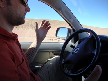 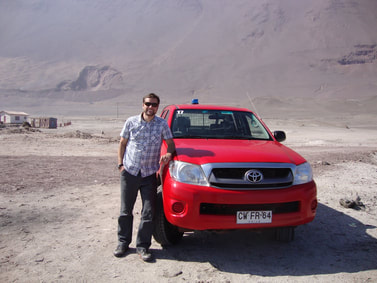 Our Hilux Many miners move around and all of the rental agencies rent these trucks already prepared for the mines with the correct safety equipment. Our particular Hilux had an internal roll bar in addition to the bed mounted external roll bar, full size spare tire and tools, and a blue, roof mounted mining light for safety. The blue light did not include a cover...which we nearly got a ticket for. More on the rules of the Chilean mining truck lighting requirements later. We left the airport heading north into town, passing the Dakar 2012 finish line and stopping at the first road to the Pacific Ocean to snap a few pics before heading to the beach in town. Surrounded by a desert with giant sand dunes, Iquique is a great city to visit and, as with most places in Chile, has great food. On the beach we found many places to eat, drink and hang out and, from what I could tell, it was a perfect surf spot. We were ready for lunch at noon but found no open restaurants. I'm learning that in Chile things take time. Lunch is usually around 1pm and since it's an important meal for most, people take the time to have a nice lunch with friends and family. As lunch would not be possible for another hour, we ran errands. After locating cash, snacks and drinks, we topped off the Hilux with diesel in preparation for our push into the Atacama. Once lunch finally rolled around, ceviche was washed down with a local beer. 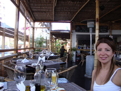 We left Iquique and headed east toward Pica, Chile. Along the way to Pica, we stopped for a look around the Humberstone and Santa Laura Saltpeter Works. Located in the north of the Atacama desert, it was originally called La Palma and was built in 1872 by the Peruvian Nitrate Company. As with many old 'company' towns, it included everything necessary to be self-sufficient; tools, machines, trains, housing and even a theater for the hard working nitrate miners. At its peak, the town had 3,700 inhabitants. We toured the town and could see that everything was much the same as it was when it closed in 1959. The nitrate field and town went through many owners over the years and Paula found this old ghost town a little creepy and unnerving. I was interested in the giant lathes in the machine shop and old trains still present. It was impressive to see that so much work was done with such old technology. Certainly it was state of the art at the time, but still quite impressive. With another 100 miles before we reached Pica, we wanted to take it slow and explore the small towns along the way. We found a few, very poor towns that appeared to exist solely to support or house the nearby mining operations. 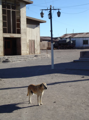 Perro in Humberstone After a slow drive and a full day, we arrived in Pica, Chile. Pica is a very small, poor desert town with huge sand dunes, desolate salt flats and remote dirt roads. We were fortunate to locate a nice place to stay in a small hotel for traveling tourists. The hotel was located on an active fruit farm surrounded by grapefruit and mangoes...needless to say the drinks were great. Having depleted our cache of snack and drinks, we were eager for dinner. The cook and kitchen staff arrived around 9pm, but this caused no undue stress as consumption of Pisco sours and house made grapefruit sours kept us relaxed. Pica is a usually visited by tourists traveling south along the main road (Highway 5) to the desert. As such, most tourists return to the highway and continue their travels. But we had a 4wd Hilux, so the road east through town, into the dunes and over the mountains was the road for us. 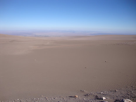 Pica to Calama The road out of Pica to the east was dirt. Most tourists and visitors arrive from the west on the main paved road. We had planned from the start to visit Salar del Guasco, whatever the road condition was and this was a major reason we rented the Hilux. The route we wanted to take was very remote and our research indicated we would find two-track desert roads. Unknown roads and road conditions found in this zone of Chile required a solid 4x4 Toyota. I also really wanted to drive a diesel Hilux to see how it compared to my personal Tacoma. At the start, the road was pretty decent and it gained elevation quickly as we entered giant sand dunes. Completely desolate and completely silent. It was impressive how silent it was. We stopped a few times to see the dunes and just take in the desert surroundings. We also began to notice that the higher we went, the worse the road surface became. The surface soon became a 1st and 2nd gear, two-track road. While the road was rocky and sandy in places, it did not require engaging the 4wd since the Hilux had a low first gear and climbed well. We soon noticed the landscape was changing. From completely sand with no vegetation to rocky ground covered with a few plants, to many plants and birds. As we drove, I kept thinking we were at the top and just over that horizon we would be heading back down to the salar, but we continued to climb for over an hour. I'm not certain what the elevation was, but it was high. Later that day I got an idea of how high we had been all day from one lone sign in the abandoned village of Yuma, Chile, along the Bolivian border and high in the Andes mountain range. 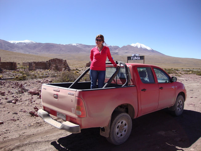 A lone sign in Yuma We arrived at the "top" or summit for this road and headed down the other side to arrive at Laguna de Huasco. It was beautiful and hard to describe. The salar, or salt flat, was teaming with wildlife. We noticed the llamas and flamingos as they came into view. The flat areas where still water had pooled beautifully mirrored the Andes and the Bolivian border. We only saw one other truck during our visit, so once the truck left we had the whole place to ourselves. I was amazed at the salt flat and the salt water in it. It was very bright and very desolate and I found the silence was quite nice. The flamingos didn't mind us as they were busy eating and the llamas didn't mind a few photos either. We wanted to stay, but we had many more salars to visit and many more kilometers of dirt to cover before we made it to San Pedro de Atacama. 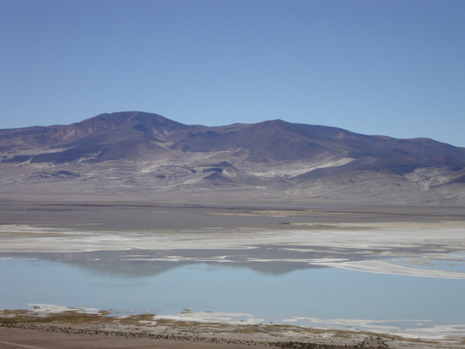 Laguna de Huasco We headed south on a sandy dirt track that required four wheel drive a couple times. After traveling sixty kilometers, we reached a split in the road. One direction headed to a very large mining operation and the other direction was a less traveled dirt track heading south. The southern track would take us way up in elevation to Yuma, Chile, a town right on the Bolivian border at 4,400 meters. Yuma was an old village sight with an abandoned stone building and an old rail road track. Very cool place. From here, the road just ended up getting worse. The funny thing was we were in a very remote area on a two-track, and out of nowhere we see a road sign pointing to different towns..some of which were likely abandoned too. Our next destination was Ollague, Chile. 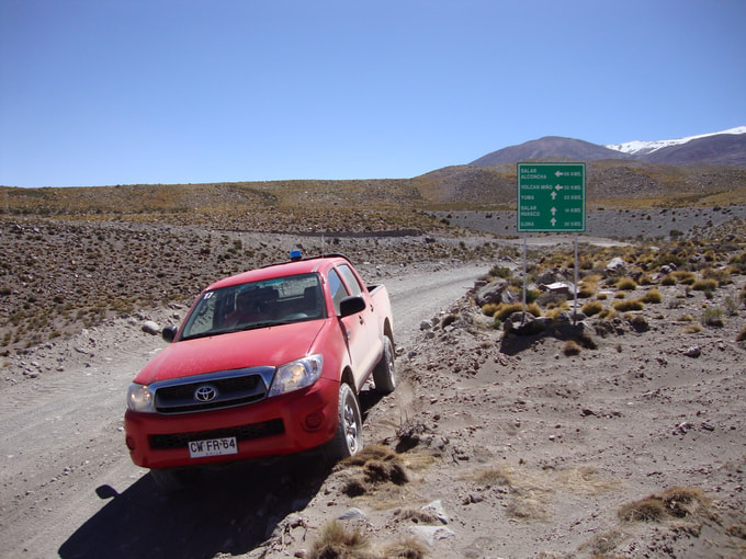 Our Hilux near the Bolivian border Ollague is a town on the Chile / Bolivia border and, as far as we could tell, had a legal crossing. The town was in a salar and directly under an active volcano that was puffing while we drove through. Ollague is an old town, with a rail station used primarily for the local mines. During our visit we saw a train leaving town, heading south to Calama. I'm not sure what was in the giant, red pot-like basins on the rail cars but they must have been heavy because they were placed directly over the train car wheels. It was very cool watching it leave town and head south across the salar, disappearing into the distance. Once the train had passed we did the same and headed south across the salar on another very sandy road running parallel to the railroad track for a while. This was a very long salar with many things going on. Salt mining, road construction and a very tiny town. We were headed for Chiu Chiu, which marked the start of paved road again and was at the north edge of Calama, Chile. We wanted to make it to Calama to fuel up and make it to San Pedro that night. The brief stop in Calama was fine with me because it was a very busy mining town and totally crazy. The road to San Pedro de Atacama was all paved. We arrived at night and that was likely the worst way to show up as the town is a crazy dirt road maze. We finally found our way to our hotel and passed out after a very long day of cruising the desert.
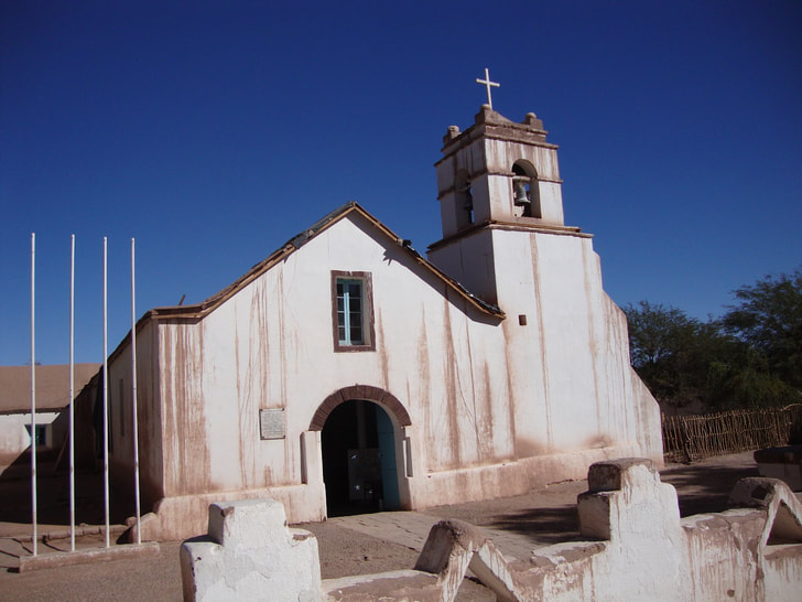
San Pedro de Atacama and Surrounding area On Saturday morning we headed south of town to Salar de Cejar. In this area were seven different salt water lagoons that were so high in salt content that one could float. After visiting one lagoon we heading to the one open for swimming! We jumped in and whoo hoo it was cold, but there was no need to tread water because we just bobbed around like a cork. It was hilarious and took a minute to get used to it. After 31 years of training to not drown and tread water, it was strange to just lay there and float around. It was such an awesome experience. My swim shorts dried up like paper once we left the salt water; they were so stiff with salt. Paula was smart and had a change of clothes. On the road again, heading for the deep, double lagoon of Ojos del Salar. An interesting lagoon compared to the others. 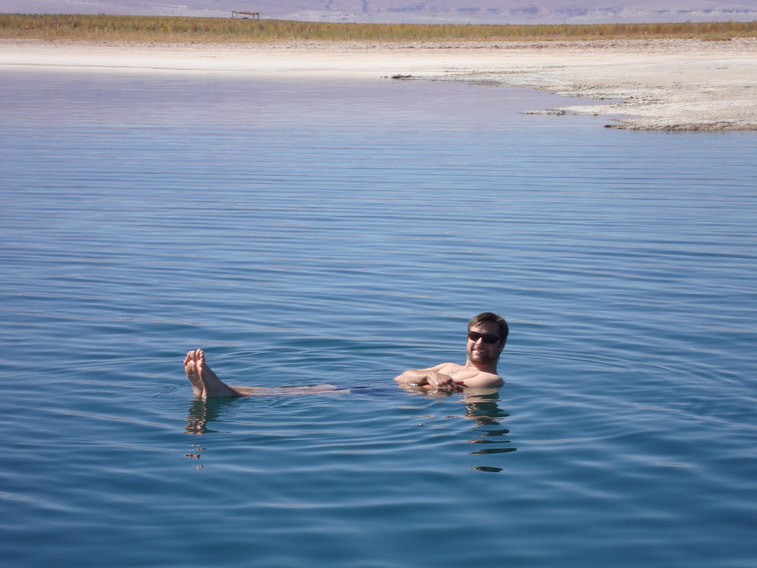 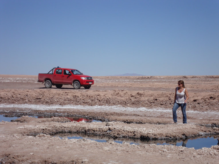 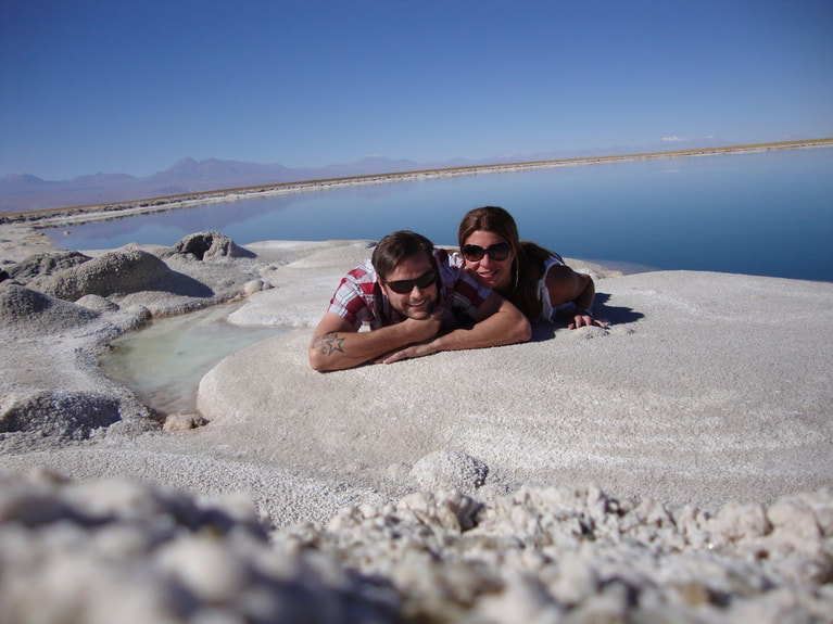 And now a word about Chilean Mining truck lights. Remember the blue, roof-mounted light on our Hilux I mentioned at the beginning of this story? Well, the blue light is there for mining safety and when you are not using the truck in a mining-related capacity, you need to place a cover over the light...a cover we were never given. In the United States we associated blue lights with the police. In Chile, the local police use red lights on there cars, so no problem there. Unfortunately for us, the PDI (Chilean FBI-equivalent) uses blue lights. It's all very confusing actually. And to make things more confusing, the local police and ambulances often drive around in the city with the lights on, but no siren. That took some getting used to. When Paula and I were leaving San Pedro to explore when we were stopped by a local officer. He was very intimidating with his big aviator sunglasses and old school officer hat like the US military uses for full dress. He was not happy about the blue light with no cover. We, of course, had no idea about the mining light rules. The rental car company provided the truck as it was sans blue light cover. The light wasn't even hooked up! Paula translated for him and I handed over my passport, international driving license and the rental form required to legally take the truck from one zone to another zone within Chile. All three documents were important. 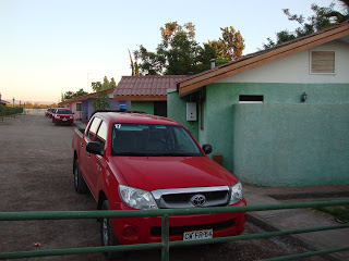 Our Hilux and the problematic blue light The officer gave Paula a hard time and said she should know the rules because she had a driving license. She responded that we obviously did not know the rules and that the truck was a rental. He did not like her answer. I was fumbling around as this was my first international police experience and I was a little nervous. Historically, the Chilean Police are known for being very fair and uncorrupted. They neither take bribes nor do they ask, and they follow the letter of the law. They are a great police force compared to many other South American nations. After a few minutes of arguing with Paula (a losing battle no matter who you are), he relented and told use to remove the light and move along. I did as I was told and laid tracks out of that situation. We laughed about it the rest of the day because Paula is a skilled arguer and he didn't stand a chance at giving us a ticket. In all seriousness, if you rent a truck in Chile's mining zones make sure when you are given the truck you and the rental agent go over every scratch, every tool, every dent, the light AND light cover. Make certain it is noted on the agreement because it shows that you were given the truck as-is and you did not intentionally break any laws. 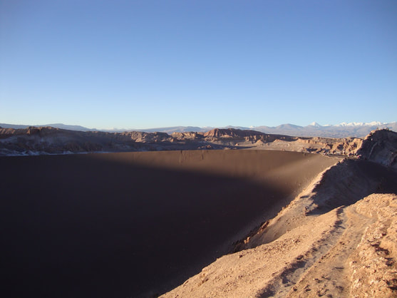 Valle de la Luna or Valley of the Moon After a full morning, it was time to head back into town and have a nap. We were beat after the drive the day before and our police experience, so we headed back and rested. That evening we had plans to head to Valle de la Luna, Valley of the Moon. We wanted to watch the sun set and the moon rise in the same spot. Lucky for us, we were treated to a spectacular moon rise and a full moon! 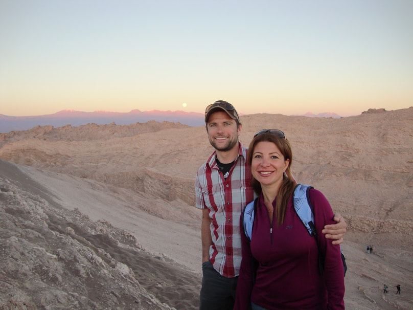 Sunday was our last day in San Pedro. We decided to stroll around the town and see the small shops, market and church in the center of town. It was a little touristy after having spent the last couple days driving the truly remote areas of northern Atacama but it was nice nonetheless.
We had lunch in a small restaurant in the town square and feed some of our pizza crust to the many local dogs. They are not wild dogs, but not completely domestic either as they belonged to no one. This Chilean dog phenomenon was first revealed to me when I visited Valparaiso, Chile on the coast. San Pedro was just as crowded, with dogs running about and hanging out like they were all on permanent vacation. Our particular perro that was taking advantage of our crust must have felt very satisfied after shrimp pizza because when we finished feeding him he promptly passed out asleep. It was hilarious.
Simply fantastic! I attended the Film Festival last weekend (May 4-6) held at the Nantahala Outdoor Center, which turned out to be the perfect location. Thanks again to the friendly staff at NOC for pulling the facility-side of this festival together. The film festival was hosted by the massively interesting and terribly funny adventure travel duo of Austin Vince and Lois Pryce. It was a genuine pleasure to finally meet and chat with them in person. Thank you, Austin and Lois! I listed all the films in an earlier post, but here's the list of the films I was able to see: Friday Wakhan First Overland Himalayan Adventure Saturday Dream: Above and Beyond Back of Beyond Twice Upon a Caravan Call of the White Mondo Enduro Sunday Grass MotoSyberia 2.0 I returned home a bit early on Sunday, but I was able to hang around long enough to catch a couple films. All of the films were excellent and unique in their own way, with Austin and Lois selecting a diverse and interesting collection of films. My personal favorite was Above and Beyond a Dream (http://www.aboveandbeyondcanada.com/) for its honest and emotional punch, but all of the films were really quite good. Austin provided a short, one hour overview on how to shoot your own documentary. The tips and suggestions were excellent. It was only $75 for a weekend of great films and great folks. In addition to the variety films, all of the presentations were interesting and well worth the time. I look forward to 2013, and the return of the Adventure Travel Film Festival to the Southeast. If this is something you are interested in, let them know you want them to return! Facebook: https://www.facebook.com/#!/AdventureTravelFilmFestivalUsaSoutheast or http://www.adventuretravelfilmfestival.com/. 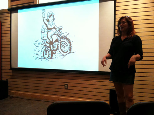 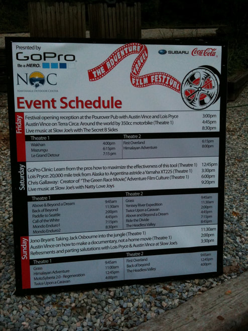 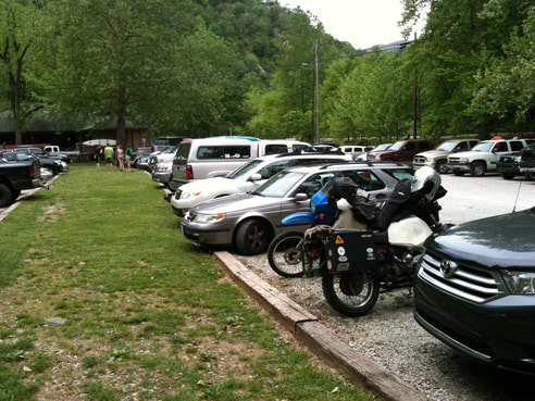 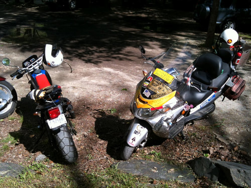 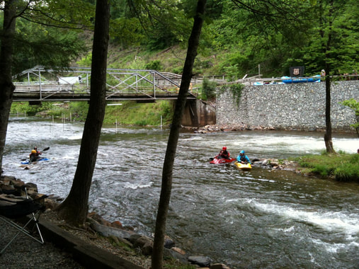 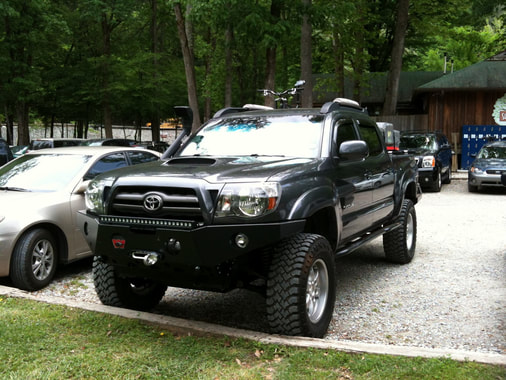 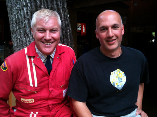 |
Archives
February 2020
|
 RSS Feed
DISCLAIMER | ABOUT | THE ADVENTURE TRAVEL LIBRARY
Copyright © 2010-2023 All Rights Reserved David Giguere | Georgia Overland | Georgia Traverse™
All materials on this site are protected by copyright and intellectual property laws and are the property of David Giguere.
Unless stated otherwise, you may access and download the materials located on www.georgiaoverland.com only for personal, non-commercial use.
You may not reproduce this material on your personal website, blog, social network, or any other online, offline, digital or print resource without permission granted by David Giguere.